
Maps
Presentation
•
Geography
•
7th Grade
•
Medium

Cole Fiegen
Used 162+ times
FREE Resource
9 Slides • 9 Questions
1
Maps
By: Mr. Fiegen

2
ALL MAPS ARE LIARS
It is impossible to repress a globe or sphere on a flat map

3
Multiple Choice
4
Multiple Choice
5
Cylindrical Projections
based on a cylinder wrapped around the globe
this causes landmasses near the poles to appear larger than they really are

6
Multiple Choice
7
Map Essentials
Title
Compass Rose
Scale
Legend
Locator Map

8
Titles
The map title shows what the subject of the map is.

9
Multiple Select
10
Compass Rose
Directional indicator shows which way north, south, east, and west lie on the map.
The way a map is drawn and the location of directions depend on that map makers perspective

11
Multiple Choice
12
Multiple Choice
13
Multiple Choice
14
Scale
Mapmakers use scales to represent the distances between points on a map
Scales give distances in miles and kilometers
This is an example of a bar scale

15
Multiple Choice
16
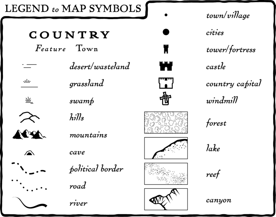
Legend/Key
Explains what the symbols on the map represent
Some legends show colors that represent certain features like empires or other regions
17
Multiple Choice
18
Locator Map
Shows where in the world the area on the map is located

Maps
By: Mr. Fiegen
Show answer
Auto Play
Slide 1 / 18
SLIDE
