
Political vs Physical Maps
Presentation
•
Social Studies
•
6th - 8th Grade
•
Hard

Joseph Anderson
FREE Resource
15 Slides • 99 Questions
1
Multiple Choice

All maps are used to help people find locations and get directions.
2

3

4

5

6

7

8
Multiple Choice

What type of map show us territorial features such as countries, states, cities, towns, and the significant bodies of water.
9
Multiple Choice

Political Maps can show different sizes of lands including large continents to small cities.
10
Multiple Choice

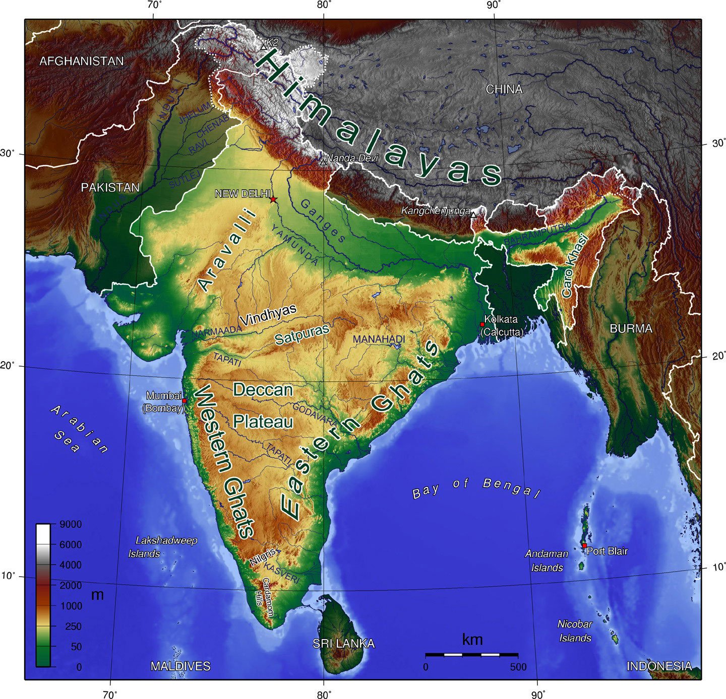
What type of map is designed to show landforms?
11
Multiple Select

What type of things are found on a physical map? Check ALL that apply.
12
Multiple Choice

There is only one type of map.
13
Multiple Choice

A map can show you where things are located.
14
Multiple Choice

What type of map shows borders of nations and cities.
15
Multiple Choice

Someone who draws maps is called a __________.
16
Multiple Choice
17
Multiple Choice
18
Multiple Choice
19
Multiple Choice
20
Multiple Choice

21
Multiple Choice
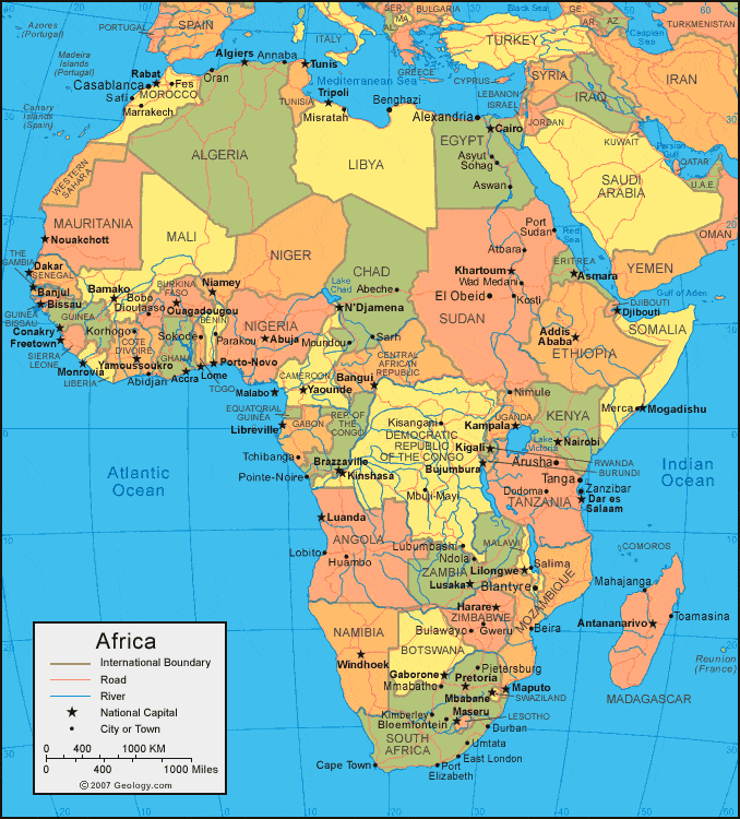
This map is an example of a . . .
22
Multiple Choice
This map is an example of a . . .
23
Multiple Choice
24

25

26

27
Multiple Choice
28
Multiple Choice
29
Multiple Choice
30
Multiple Choice
31
Multiple Choice
32
Multiple Choice
33
Multiple Choice

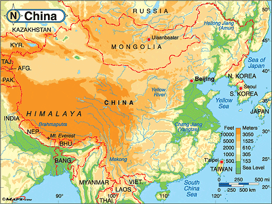
What type of map is this?
34
Multiple Choice

What type of map is this?
35
Multiple Choice
36
Multiple Select
37
Multiple Choice

This map is a...
38
Multiple Choice
39
Multiple Choice
This map is an example of a . . .
40
Multiple Choice
This map is an example of a . . .
41
Multiple Choice
42

43
44

45

46
Multiple Choice
47
Multiple Choice
48
Multiple Choice
49
Multiple Choice

What are the lines that run east and west along the globe and use the prime meridian as a reference
50
Multiple Choice
What are the parallel lines that run north and south on the globe and use the equator as a reference?
51
Multiple Choice
52
Multiple Choice

53
Multiple Choice
54
Multiple Choice

55
Multiple Choice

56
Multiple Choice

57
Multiple Choice
58
Multiple Choice

What type of map is this?
59
Multiple Choice
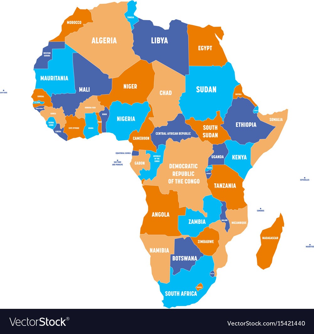
What type of map is this?
60
Multiple Choice

What type of map is this?
61
Multiple Choice
This is a physical map. How can we tell?
62
Multiple Choice

What type of map is this?
63
Multiple Select

This is a physical map. How can we tell?
64
Multiple Choice

What type of map is this?
65
Multiple Choice

This is a political map. How can we tell?
66
Multiple Choice

What type of map is this?
67
Multiple Select

This is a political map. How can we tell?
68
Multiple Choice

What type of map is this?
69
Multiple Choice

What type of map is this?
70
Multiple Choice

What type of map is this?
71
Multiple Choice

What type of map is this?
72
Multiple Choice

What type of map is this?
73
Multiple Choice

What type of map is this?
74
Multiple Choice
75
Multiple Choice
76
Multiple Choice
What type of map is this?
77
Multiple Choice
What type of map is this?
78
Multiple Choice
What type of map is this?
79
Multiple Select
This is a political map. How can we tell?
80
Multiple Choice

What type of map is this?
81

82
Multiple Choice
83
Multiple Choice

Major cities and capital cities noted on map
84
Multiple Choice

Name the type of map.
85
Multiple Choice

Name the type of map
86
Multiple Choice

Name the type of map.
87
Multiple Choice

In this Physical Map of Missouri, what does the darker brown areas represent?
88
Multiple Choice
89
Multiple Choice
90
Multiple Choice
91
Multiple Choice
92
Multiple Choice
93
Multiple Choice
94
Multiple Choice
95
Multiple Choice
96
Multiple Choice
97
Multiple Choice
98
Multiple Choice

99
Multiple Choice

100
Multiple Choice

101
Multiple Choice

102
Multiple Choice

Places that are close together and share characteristics
103
Multiple Choice

Identify the part of the map shown.
104
Multiple Choice

Identify the part of the map shown.
105
Multiple Choice

Identify the part of the map shown.
106
Multiple Choice

Identify the part of a map shown.
107
Multiple Choice

What type of lines are shown in the image?
108
Multiple Choice

True or False: This is an example of a physical map.
109
Multiple Choice

What title is correct for this map?
110
Multiple Choice

This map is an example of a...
111
Multiple Choice

This map is an example of a...
112
Multiple Choice

This map is an example of a...
113
Multiple Choice
114

All maps are used to help people find locations and get directions.
Show answer
Auto Play
Slide 1 / 114
MULTIPLE CHOICE
