Warm-up: Using Maps
Science
9th - 12th Grade
NGSS covered
Used 100+ times

AI Actions
Add similar questions
Adjust reading levels
Convert to real-world scenario
Translate activity
More...
Content View
Student View
10 questions
Show all answers
1.
MULTIPLE CHOICE QUESTION
1 min • 1 pt

Location D is located at which coordinates?
30oN, 90oW
90oN, 30oW
10oN, 40oW
30oN, 90oE
Tags
CCSS.5.G.A.1
2.
MULTIPLE CHOICE QUESTION
2 mins • 1 pt

What is the name of this line at 0 degrees latitude?
3.
MULTIPLE CHOICE QUESTION
2 mins • 1 pt
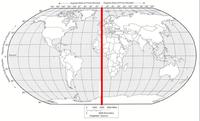
What is the name of the line at zero degrees longitude?
4.
MULTIPLE CHOICE QUESTION
30 sec • 1 pt

What city is located at 32 degrees south and 150 degrees east?
5.
MULTIPLE CHOICE QUESTION
2 mins • 1 pt

What direction is the warm front moving?
Northwest
Southeast
Northeast
Southwest
Tags
NGSS.MS-ESS2-5
6.
MULTIPLE CHOICE QUESTION
30 sec • 1 pt

Where is the United States experiencing the most wind?
Northwest, near the coast of Washington State and Oregon
Southwest, near Florida
Northeast, off the coast of Maine
Southwest, near Mexico
Tags
NGSS.MS-ESS2-5
NGSS.MS-ESS2-6
7.
MULTIPLE CHOICE QUESTION
2 mins • 1 pt

Scale is 1in = 8mi. Hatboro and Smithville are 24 miles apart on the map, how far apart are they?
87 mi
30 in
6 in
3 in
Tags
CCSS.7.RP.A.2C


Access all questions and much more by creating a free account
Create resources
Host any resource
Get auto-graded reports
Continue with Google

Continue with Email
Continue with Microsoft
or continue with

%20(1).png)
Apple
Others
Already have an account?
