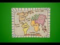
Drawing the Continents and Oceans
Interactive Video
•
Social Studies
•
6th - 10th Grade
•
Practice Problem
•
Hard

Ethan Morris
FREE Resource
Read more
10 questions
Show all answers
1.
MULTIPLE CHOICE QUESTION
30 sec • 1 pt
What is the first step in drawing the seven continents?
Labeling the continents
Coloring the map
Putting dots at specific points
Drawing a straight line
2.
MULTIPLE CHOICE QUESTION
30 sec • 1 pt
Which type of lines are primarily used to draw the continents?
Wavy lines
Dotted lines
Zigzag lines
Straight lines
3.
MULTIPLE CHOICE QUESTION
30 sec • 1 pt
What should you do if your drawing of a continent looks squished?
Ignore it and continue
Use a ruler to fix it
Erase and start over
Ask for help
4.
MULTIPLE CHOICE QUESTION
30 sec • 1 pt
Which continent is labeled at the very bottom of the map?
Australia
Antarctica
Africa
South America
5.
MULTIPLE CHOICE QUESTION
30 sec • 1 pt
What color should you avoid using for the continents?
Yellow
Blue
Red
Green
6.
MULTIPLE CHOICE QUESTION
30 sec • 1 pt
How many colors should you pick for the continents?
Six
Five
Eight
Seven
7.
MULTIPLE CHOICE QUESTION
30 sec • 1 pt
What is the main reason Earth is called the 'big blue marble'?
It has many mountains
It has many deserts
It has a lot of water
It has large forests
Access all questions and much more by creating a free account
Create resources
Host any resource
Get auto-graded reports
Continue with Google

Continue with Email
Continue with Classlink
Continue with Clever
or continue with
Microsoft
%20(1).png)
Apple
Others
Already have an account?
