- Resource Library
- Social Studies
- Geography
- Latitude And Longitude
- Exploring Latitude And Longitude Concepts
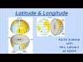
Exploring Latitude and Longitude Concepts
Interactive Video
•
Social Studies
•
6th - 10th Grade
•
Practice Problem
•
Easy

Ethan Morris
Used 1+ times
FREE Resource
Read more
10 questions
Show all answers
1.
MULTIPLE CHOICE QUESTION
30 sec • 1 pt
What do latitude lines measure?
Distance in degrees east and west of the Prime Meridian
Distance in miles from the equator
Distance in degrees north and south of the equator
Distance in kilometers from the poles
2.
MULTIPLE CHOICE QUESTION
30 sec • 1 pt
Which line is the major latitude line?
Prime Meridian
Tropic of Cancer
Equator
Tropic of Capricorn
3.
MULTIPLE CHOICE QUESTION
30 sec • 1 pt
What do longitude lines measure?
Distance in degrees north and south of the equator
Distance in miles from the equator
Distance in degrees east and west of the Prime Meridian
Distance in kilometers from the poles
4.
MULTIPLE CHOICE QUESTION
30 sec • 1 pt
Which line is the main longitude line?
Tropic of Cancer
Tropic of Capricorn
Equator
Prime Meridian
5.
MULTIPLE CHOICE QUESTION
30 sec • 1 pt
How can you identify a longitude line?
It is parallel to the equator
It runs vertically
It is parallel to the Tropic of Cancer
It runs horizontally
6.
MULTIPLE CHOICE QUESTION
30 sec • 1 pt
What is the latitude of the equator?
60 degrees south
30 degrees north
0 degrees
90 degrees north
7.
MULTIPLE CHOICE QUESTION
30 sec • 1 pt
What is the longitude of the Prime Meridian?
60 degrees west
90 degrees east
0 degrees
30 degrees east
Access all questions and much more by creating a free account
Create resources
Host any resource
Get auto-graded reports
Continue with Google

Continue with Email
Continue with Classlink
Continue with Clever
or continue with
Microsoft
%20(1).png)
Apple
Others
Already have an account?
Popular Resources on Wayground

15 questions
Fractions on a Number Line
Quiz
•
3rd Grade
20 questions
Equivalent Fractions
Quiz
•
3rd Grade
25 questions
Multiplication Facts
Quiz
•
5th Grade
29 questions
Alg. 1 Section 5.1 Coordinate Plane
Quiz
•
9th Grade
22 questions
fractions
Quiz
•
3rd Grade
11 questions
FOREST Effective communication
Lesson
•
KG
20 questions
Main Idea and Details
Quiz
•
5th Grade
20 questions
Context Clues
Quiz
•
6th Grade
Discover more resources for Social Studies
15 questions
Ce.9a-b Understanding Media and Its Role in Society
Quiz
•
8th Grade
14 questions
Cotton, Cattle and Railroads
Quiz
•
7th Grade
11 questions
The Cuban Missile Crisis Extra History Part 1
Interactive video
•
6th - 8th Grade
7 questions
The Dust Bowl
Interactive video
•
6th - 8th Grade
17 questions
World War 2 (World History 25-26)
Quiz
•
9th Grade
24 questions
Post WWII + Civil Rights
Quiz
•
8th Grade
43 questions
8th Social Studies STAAR Released Questions - 2021
Quiz
•
8th Grade
21 questions
8th Grade STAAR Review US History
Quiz
•
8th Grade