Exploring Weather Maps and Station Models
Interactive Video
•
Science
•
6th - 10th Grade
•
Practice Problem
•
Hard
Standards-aligned

Ethan Morris
FREE Resource
Standards-aligned
Read more
10 questions
Show all answers
1.
MULTIPLE CHOICE QUESTION
30 sec • 1 pt
What is the primary purpose of weather maps?
To provide information about historical events
To indicate the political boundaries of countries
To display various weather conditions and patterns
To show the population density of an area
Tags
NGSS.MS-ESS2-5
NGSS.MS-ESS2-6
2.
MULTIPLE CHOICE QUESTION
30 sec • 1 pt
What does a radar map primarily show?
Cloud cover
Temperature variations
Precipitation
Wind speed
Tags
NGSS.MS-ESS2-4
3.
MULTIPLE CHOICE QUESTION
30 sec • 1 pt
What do satellite images typically display?
Cloud cover
Air pressure
Wind direction
Rainfall amounts
4.
MULTIPLE CHOICE QUESTION
30 sec • 1 pt
What information can computer models provide?
Political boundaries
Population density
Patterns such as rainfall and fronts
Historical weather data
Tags
NGSS.MS-ESS2-6
5.
MULTIPLE CHOICE QUESTION
30 sec • 1 pt
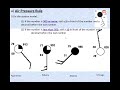
What is a station model used for?
To provide historical weather data
To indicate the location of mountains
To show detailed weather information in a small area
To display the population of a city
6.
MULTIPLE CHOICE QUESTION
30 sec • 1 pt
What does the circle in the center of a station model represent?
Cloud cover
Air temperature
Wind speed
Precipitation
7.
MULTIPLE CHOICE QUESTION
30 sec • 1 pt
How is wind direction indicated in a station model?
By the number in the top left corner
By the color of the circle
By the long line extending from the circle
By the number in the bottom right corner
Access all questions and much more by creating a free account
Create resources
Host any resource
Get auto-graded reports
Continue with Google

Continue with Email
Continue with Classlink
Continue with Clever
or continue with
Microsoft
%20(1).png)
Apple
Others
Already have an account?
Similar Resources on Wayground

9 questions
Understanding the Moon's Drift and Orbital Mechanics
Interactive video
•
7th - 12th Grade
11 questions
Innovative Uses of AI
Interactive video
•
7th - 12th Grade
11 questions
Understanding the Evolution of the Meter
Interactive video
•
7th - 12th Grade
8 questions
MIT Has Predicted that Society Will Collapse in 2040: The Outcomes & Criticisms
Interactive video
•
7th - 12th Grade
9 questions
Understanding Literature Structure
Interactive video
•
7th - 12th Grade
Popular Resources on Wayground
15 questions
Fractions on a Number Line
Quiz
•
3rd Grade
20 questions
Equivalent Fractions
Quiz
•
3rd Grade
25 questions
Multiplication Facts
Quiz
•
5th Grade
54 questions
Analyzing Line Graphs & Tables
Quiz
•
4th Grade
22 questions
fractions
Quiz
•
3rd Grade
20 questions
Main Idea and Details
Quiz
•
5th Grade
20 questions
Context Clues
Quiz
•
6th Grade
15 questions
Equivalent Fractions
Quiz
•
4th Grade
Discover more resources for Science
20 questions
Cell Organelles and Functions
Quiz
•
6th - 8th Grade
33 questions
Grade 6 Quarter 3 PMA 5 Review
Quiz
•
6th - 8th Grade
20 questions
Rocks and The Rock Cycle
Quiz
•
6th Grade
12 questions
Ecological Succession
Quiz
•
7th Grade
20 questions
Thermal Energy - Heat Transfer
Quiz
•
6th Grade
10 questions
Exploring the Rock Cycle: Types and Formation
Interactive video
•
6th - 8th Grade
10 questions
Exploring the Layers of the Earth
Interactive video
•
6th - 10th Grade
15 questions
Punnett Squares
Quiz
•
6th Grade