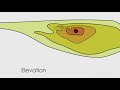
Understanding Topography
Interactive Video
•
Geography, Science
•
6th - 10th Grade
•
Practice Problem
•
Medium

Aiden Montgomery
Used 6+ times
FREE Resource
Read more
9 questions
Show all answers
1.
MULTIPLE CHOICE QUESTION
30 sec • 1 pt
What does the study of topography primarily focus on?
The study of weather patterns
The study of ocean currents
The study of land surface shapes
The study of celestial bodies
2.
MULTIPLE CHOICE QUESTION
30 sec • 1 pt
Which feature is NOT typically analyzed by topographers?
Cloud formations
Rivers
Mountains
Crater
3.
MULTIPLE CHOICE QUESTION
30 sec • 1 pt
Which of the following is NOT a primary goal of topography?
Determining latitude
Measuring temperature
Finding longitude
Calculating elevation
4.
MULTIPLE CHOICE QUESTION
30 sec • 1 pt
What is a contour line used for in topographic maps?
To show elevation
To indicate temperature
To display population density
To measure distance
5.
MULTIPLE CHOICE QUESTION
30 sec • 1 pt
How can you tell a steep slope from a gentle slope on a topographic map?
By the color of the lines
By the thickness of the lines
By the length of the lines
By the spacing of the contour lines
6.
MULTIPLE CHOICE QUESTION
30 sec • 1 pt
What is the significance of closed contour lines on a topographic map?
They indicate a gentle slope
They show a steep slope
They represent a flat area
They mark a water body
7.
MULTIPLE CHOICE QUESTION
30 sec • 1 pt
What is the primary purpose of creating a topographic map?
To illustrate historical events
To represent elevation on a flat surface
To display weather patterns
To show political boundaries
Access all questions and much more by creating a free account
Create resources
Host any resource
Get auto-graded reports
Continue with Google

Continue with Email
Continue with Classlink
Continue with Clever
or continue with
Microsoft
%20(1).png)
Apple
Others
Already have an account?
Similar Resources on Wayground

11 questions
Exploring the Five Themes of Geography
Interactive video
•
6th - 10th Grade
11 questions
Exploring Tangents and Radii in Circles
Interactive video
•
6th - 10th Grade
11 questions
Exploring Angle Pair Relationships
Interactive video
•
6th - 10th Grade
11 questions
Wells' Heroic Actions on 9/11
Interactive video
•
6th - 10th Grade
11 questions
Exploring Elements of Poetry for 4th Graders
Interactive video
•
6th - 10th Grade
11 questions
Mastering Map Skills Techniques
Interactive video
•
6th - 10th Grade
11 questions
Exploring Angles and Degrees in Geometry
Interactive video
•
6th - 10th Grade
Popular Resources on Wayground
15 questions
Fractions on a Number Line
Quiz
•
3rd Grade
20 questions
Equivalent Fractions
Quiz
•
3rd Grade
25 questions
Multiplication Facts
Quiz
•
5th Grade
22 questions
fractions
Quiz
•
3rd Grade
20 questions
Main Idea and Details
Quiz
•
5th Grade
20 questions
Context Clues
Quiz
•
6th Grade
15 questions
Equivalent Fractions
Quiz
•
4th Grade
20 questions
Figurative Language Review
Quiz
•
6th Grade
Discover more resources for Geography
20 questions
Plate Tectonics and Earth's Structure
Quiz
•
6th Grade
21 questions
Continents and Oceans
Quiz
•
6th Grade
13 questions
Russia Lesson 1 pg 358
Quiz
•
9th Grade
14 questions
Russia lesson 2 p363-371
Quiz
•
9th Grade
28 questions
SE Asia Government and Economic Systems Review
Quiz
•
7th Grade
20 questions
European Countries
Quiz
•
6th Grade
11 questions
How do volcanoes and earthquakes happen?
Passage
•
9th Grade
16 questions
SS7G3 Africa's Population and Trade
Quiz
•
7th Grade