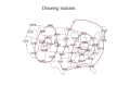
Understanding Weather Maps and ISO Lines
Interactive Video
•
Science, Geography
•
5th - 8th Grade
•
Practice Problem
•
Medium

Ethan Morris
Used 1+ times
FREE Resource
Read more
10 questions
Show all answers
1.
MULTIPLE CHOICE QUESTION
30 sec • 1 pt
What does the term 'ISO' signify in the context of weather maps?
Variable
Different
Equal or the same
Opposite
2.
MULTIPLE CHOICE QUESTION
30 sec • 1 pt
What do isobars represent on a weather map?
Equal wind speeds
Equal humidity levels
Equal temperatures
Equal air pressures
3.
MULTIPLE CHOICE QUESTION
30 sec • 1 pt
When drawing isobars, what is the typical increment used?
2 millibars
4 millibars
6 millibars
8 millibars
4.
MULTIPLE CHOICE QUESTION
30 sec • 1 pt
What should you do if you encounter a number that doesn't fit the increment pattern when drawing isobars?
Ignore it
Draw a separate line
Connect it anyway
Change the increment
5.
MULTIPLE CHOICE QUESTION
30 sec • 1 pt
How can you identify a high-pressure area on a weather map?
By the color blue
By the color red
By the letter L
By the letter H
6.
MULTIPLE CHOICE QUESTION
30 sec • 1 pt
What weather conditions are typically associated with high-pressure areas?
Snowy and cold
Windy and cloudy
Clear and sunny
Rainy and stormy
7.
MULTIPLE CHOICE QUESTION
30 sec • 1 pt
What is the key difference between isobars and isotherms?
Isobars connect equal temperatures, isotherms connect equal pressures
Isobars connect equal wind speeds, isotherms connect equal humidity
Isobars connect equal pressures, isotherms connect equal temperatures
Isobars connect equal humidity, isotherms connect equal wind speeds
Access all questions and much more by creating a free account
Create resources
Host any resource
Get auto-graded reports
Continue with Google

Continue with Email
Continue with Classlink
Continue with Clever
or continue with
Microsoft
%20(1).png)
Apple
Others
Already have an account?
