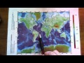
Understanding Map Colors and Features
Interactive Video
•
Geography
•
5th - 8th Grade
•
Practice Problem
•
Hard

Ethan Morris
FREE Resource
Read more
10 questions
Show all answers
1.
MULTIPLE CHOICE QUESTION
30 sec • 1 pt
What does the blue color on the geography map represent?
Vegetation cover
Elevation in meters above sea level
Temperature
Population density
2.
MULTIPLE CHOICE QUESTION
30 sec • 1 pt
Which colors on the map indicate high elevations such as mountains?
Black and white
Orange and red
Blue and purple
Green and yellow
3.
MULTIPLE CHOICE QUESTION
30 sec • 1 pt
Which mountain range is indicated by the orange and red colors on the map?
Rocky Mountains
Appalachian Mountains
Ural Mountains
Andes Mountains
4.
MULTIPLE CHOICE QUESTION
30 sec • 1 pt
Where is Mount Everest located according to the map?
Himalayan Mountains
Alps
Andes Mountains
Rocky Mountains
5.
MULTIPLE CHOICE QUESTION
30 sec • 1 pt
What geographical feature is indicated by the light blue and whitish colors on the map?
Deep ocean trenches
Mountain peaks
Shallow ocean areas
Desert regions
6.
MULTIPLE CHOICE QUESTION
30 sec • 1 pt
What is the term for the underwater landmass that extends from a continent, indicated by shallow areas on the map?
Abyssal plain
Continental shelf
Seamount
Oceanic ridge
7.
MULTIPLE CHOICE QUESTION
30 sec • 1 pt
As the color on the map gets darker blue, what does it indicate about the ocean?
The ocean is getting deeper
The ocean is getting shallower
The ocean is getting warmer
The ocean is getting saltier
Access all questions and much more by creating a free account
Create resources
Host any resource
Get auto-graded reports
Continue with Google

Continue with Email
Continue with Classlink
Continue with Clever
or continue with
Microsoft
%20(1).png)
Apple
Others
Already have an account?
Popular Resources on Wayground

15 questions
Fractions on a Number Line
Quiz
•
3rd Grade
20 questions
Equivalent Fractions
Quiz
•
3rd Grade
25 questions
Multiplication Facts
Quiz
•
5th Grade
29 questions
Alg. 1 Section 5.1 Coordinate Plane
Quiz
•
9th Grade
22 questions
fractions
Quiz
•
3rd Grade
11 questions
FOREST Effective communication
Lesson
•
KG
20 questions
Main Idea and Details
Quiz
•
5th Grade
20 questions
Context Clues
Quiz
•
6th Grade
Discover more resources for Geography
14 questions
Round One - State Savvy
Quiz
•
7th - 8th Grade
52 questions
2nd Semester Interim Review 35, 36, 37, 38, 39, 40, 50
Quiz
•
7th Grade
14 questions
Awesome Adventures
Quiz
•
8th Grade
14 questions
Round 6: Odd One Out
Quiz
•
7th - 8th Grade
14 questions
Round 5 - History Happens
Quiz
•
7th Grade
22 questions
Northeast States and Capitals
Quiz
•
5th Grade
14 questions
Round 6 Odd One Out
Quiz
•
7th Grade
14 questions
Round 2: State Stats
Quiz
•
7th Grade