Earth's Surface Changes and Processes
Interactive Video
•
Science, Geography
•
5th - 8th Grade
•
Practice Problem
•
Medium

Amelia Wright
Used 14+ times
FREE Resource
Read more
10 questions
Show all answers
1.
MULTIPLE CHOICE QUESTION
30 sec • 1 pt
What type of change is a volcanic eruption considered to be?
Constructive
Erosive
Destructive
Neutral
2.
MULTIPLE CHOICE QUESTION
30 sec • 1 pt
Which of the following is a rapid destructive change?
Tsunami
Erosion
Weathering
Deposition
3.
MULTIPLE CHOICE QUESTION
30 sec • 1 pt
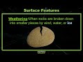
What process involves the breaking down of rocks into smaller pieces?
Erosion
Weathering
Deposition
Sedimentation
4.
MULTIPLE CHOICE QUESTION
30 sec • 1 pt
Which natural force is responsible for creating sand dunes?
Wind
Ice
Earthquakes
Water
5.
MULTIPLE CHOICE QUESTION
30 sec • 1 pt
What is the final step in the process of changing Earth's surface?
Erosion
Weathering
Melting
Deposition
6.
MULTIPLE CHOICE QUESTION
30 sec • 1 pt
How are canyons like the Grand Canyon primarily formed?
By wind erosion
By tectonic shifts
By river erosion
By volcanic activity
7.
MULTIPLE CHOICE QUESTION
30 sec • 1 pt
What natural process can create underground caverns?
Wind erosion
Water runoff
Volcanic eruptions
Ice wedging
Access all questions and much more by creating a free account
Create resources
Host any resource
Get auto-graded reports
Continue with Google

Continue with Email
Continue with Classlink
Continue with Clever
or continue with
Microsoft
%20(1).png)
Apple
Others
Already have an account?
Similar Resources on Wayground

3 questions
Las reacciones de oxidación
Interactive video
•
4th - 9th Grade
3 questions
Weather Things: Water Phases
Interactive video
•
6th - 9th Grade
11 questions
Understanding Logarithms
Interactive video
•
6th - 10th Grade
11 questions
Exploring Weathering, Erosion, and Deposition
Interactive video
•
6th - 10th Grade
6 questions
Greek football team arrive for the World Cup
Interactive video
•
6th - 7th Grade
6 questions
I WONDER - How Do Volcanoes Form?
Interactive video
•
KG - 6th Grade
7 questions
Exploring the Rock Cycle and Types of Rocks
Interactive video
•
6th - 10th Grade
Popular Resources on Wayground
15 questions
Fractions on a Number Line
Quiz
•
3rd Grade
20 questions
Equivalent Fractions
Quiz
•
3rd Grade
25 questions
Multiplication Facts
Quiz
•
5th Grade
54 questions
Analyzing Line Graphs & Tables
Quiz
•
4th Grade
22 questions
fractions
Quiz
•
3rd Grade
20 questions
Main Idea and Details
Quiz
•
5th Grade
20 questions
Context Clues
Quiz
•
6th Grade
15 questions
Equivalent Fractions
Quiz
•
4th Grade
Discover more resources for Science
20 questions
The Water Cycle
Quiz
•
5th Grade
20 questions
Cell Organelles and Functions
Quiz
•
6th - 8th Grade
33 questions
Grade 6 Quarter 3 PMA 5 Review
Quiz
•
6th - 8th Grade
20 questions
Rocks and The Rock Cycle
Quiz
•
6th Grade
20 questions
Weathering, Erosion, Deposition
Quiz
•
5th Grade
20 questions
Food Chains and Food Webs Review
Quiz
•
5th Grade
28 questions
4th Grade The Need for Speed
Quiz
•
3rd - 5th Grade
12 questions
Ecological Succession
Quiz
•
7th Grade