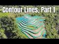
Understanding Contour Lines and Elevation
Interactive Video
•
Science, Geography, Architecture
•
5th - 8th Grade
•
Practice Problem
•
Hard

Amelia Wright
FREE Resource
Read more
10 questions
Show all answers
1.
MULTIPLE CHOICE QUESTION
30 sec • 1 pt
Why is it important to understand maps with contour lines?
To predict weather patterns
To identify wildlife habitats
To better understand land elevation and slope
To navigate through cities
2.
MULTIPLE CHOICE QUESTION
30 sec • 1 pt
What does the term 'sea level' refer to?
The depth of the ocean
The average height of the ocean's surface
The lowest point on land
The highest point of a mountain
3.
MULTIPLE CHOICE QUESTION
30 sec • 1 pt
Which unit is commonly used in the U.S. to measure elevation?
Meters
Feet
Inches
Kilometers
4.
MULTIPLE CHOICE QUESTION
30 sec • 1 pt
What do contour lines on a map represent?
The distance between cities
The temperature of a region
The height of land above sea level
The depth of the ocean
5.
MULTIPLE CHOICE QUESTION
30 sec • 1 pt
What is a contour interval?
The time taken to climb a hill
The horizontal distance between two points
The vertical distance between adjacent contour lines
The distance between two cities
6.
MULTIPLE CHOICE QUESTION
30 sec • 1 pt
How can you tell if a slope is steep by looking at contour lines?
The contour lines are closer together
The contour lines are farther apart
The contour lines are missing
The contour lines are colored differently
7.
MULTIPLE CHOICE QUESTION
30 sec • 1 pt
What does it mean if contour lines are close together on a map?
The land is flat
The slope is steep
The area is underwater
The land is at sea level
Access all questions and much more by creating a free account
Create resources
Host any resource
Get auto-graded reports
Continue with Google

Continue with Email
Continue with Classlink
Continue with Clever
or continue with
Microsoft
%20(1).png)
Apple
Others
Already have an account?
Similar Resources on Wayground
Popular Resources on Wayground

15 questions
Fractions on a Number Line
Quiz
•
3rd Grade
20 questions
Equivalent Fractions
Quiz
•
3rd Grade
25 questions
Multiplication Facts
Quiz
•
5th Grade
29 questions
Alg. 1 Section 5.1 Coordinate Plane
Quiz
•
9th Grade
22 questions
fractions
Quiz
•
3rd Grade
11 questions
FOREST Effective communication
Lesson
•
KG
20 questions
Main Idea and Details
Quiz
•
5th Grade
20 questions
Context Clues
Quiz
•
6th Grade
Discover more resources for Science
22 questions
Phases of the moon
Quiz
•
8th Grade
12 questions
Structures and Functions
Quiz
•
3rd - 5th Grade
20 questions
Rocks and The Rock Cycle
Quiz
•
6th Grade
20 questions
Weathering, Erosion, Deposition
Quiz
•
5th Grade
20 questions
Food Chains and Food Webs Review
Quiz
•
5th Grade
15 questions
Rock Cycle
Quiz
•
6th Grade
17 questions
5.9B Food Chain & Food Web 2.0
Quiz
•
5th Grade
10 questions
Exploring the Rock Cycle
Interactive video
•
6th - 8th Grade