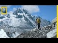
Mapping Climate Change on Mount Everest
Interactive Video
•
Science, Geography
•
9th - 12th Grade
•
Practice Problem
•
Medium

Emma Peterson
Used 5+ times
FREE Resource
Read more
10 questions
Show all answers
1.
MULTIPLE CHOICE QUESTION
30 sec • 1 pt
What is the primary focus of the expedition discussed in the video?
Exploring new climbing routes on Mount Everest
Mapping the flora and fauna of the Everest region
Studying the impact of climate change on high mountain regions
Documenting the history of Mount Everest expeditions
2.
MULTIPLE CHOICE QUESTION
30 sec • 1 pt
When did large-scale detailed mapping of Mount Everest begin?
Mid 19th century
Early 20th century
1920s
1950s
3.
MULTIPLE CHOICE QUESTION
30 sec • 1 pt
What is the consequence of the Khumbu Glacier melting?
Increased tourism in the region
Initial increase and then decrease in water availability
More climbing routes opening up
Improved weather conditions for expeditions
4.
MULTIPLE CHOICE QUESTION
30 sec • 1 pt
What technology is used to map the Khumbu Glacier?
Satellite imagery
Traditional surveying tools
LiDAR and drones
Underwater sonar
5.
MULTIPLE CHOICE QUESTION
30 sec • 1 pt
What is the purpose of using a helicopter in the mapping process?
To rescue climbers in distress
To attach a LiDAR system and create a detailed map
To provide aerial views for tourists
To transport equipment to base camp
6.
MULTIPLE CHOICE QUESTION
30 sec • 1 pt
What is the ultimate goal of the mapping project on Mount Everest?
To find new climbing routes
To generate new science and address climate change
To create a virtual reality experience for tourists
To document the history of Everest expeditions
7.
MULTIPLE CHOICE QUESTION
30 sec • 1 pt
How has the Khumbu Glacier changed over time?
It has expanded significantly
It has remained stable
It has receded and lost ice
It has become more accessible for climbers
Access all questions and much more by creating a free account
Create resources
Host any resource
Get auto-graded reports
Continue with Google

Continue with Email
Continue with Classlink
Continue with Clever
or continue with
Microsoft
%20(1).png)
Apple
Others
Already have an account?
Similar Resources on Wayground

11 questions
Understanding Hydrogeomatics and Its Impact
Interactive video
•
10th - 12th Grade
11 questions
Understanding Data Computation and Natural Language Processing
Interactive video
•
10th Grade - University
6 questions
Waterfalls Formation and Characteristics Quiz
Interactive video
•
9th - 10th Grade
6 questions
Understanding Lidar and Flood Mapping
Interactive video
•
9th - 10th Grade
6 questions
Science and Technology Quiz
Interactive video
•
9th - 10th Grade
6 questions
Yukon River Quiz
Interactive video
•
9th - 10th Grade
11 questions
Human Genome Project Overview
Interactive video
•
10th - 12th Grade
Popular Resources on Wayground
8 questions
Spartan Way - Classroom Responsible
Quiz
•
9th - 12th Grade
15 questions
Fractions on a Number Line
Quiz
•
3rd Grade
14 questions
Boundaries & Healthy Relationships
Lesson
•
6th - 8th Grade
20 questions
Equivalent Fractions
Quiz
•
3rd Grade
3 questions
Integrity and Your Health
Lesson
•
6th - 8th Grade
25 questions
Multiplication Facts
Quiz
•
5th Grade
9 questions
FOREST Perception
Lesson
•
KG
20 questions
Main Idea and Details
Quiz
•
5th Grade
Discover more resources for Science
25 questions
Naming Ionic and Covalent Compounds
Quiz
•
9th Grade
10 questions
Exploring the Evolution of the Peppered Moth
Interactive video
•
6th - 10th Grade
35 questions
DNA Structure and Replication
Quiz
•
10th Grade
10 questions
Exploring Trophic Levels and Food Pyramids
Interactive video
•
6th - 10th Grade
28 questions
Spring DPM Review
Quiz
•
9th Grade
15 questions
Chemical Reactions (Types of Chemical Reactions)
Interactive video
•
11th Grade
10 questions
Symbiotic Relationships
Lesson
•
9th - 12th Grade
13 questions
DNA Mutations
Quiz
•
9th Grade