Environmental Technologies and Data Collection
Interactive Video
•
Science, Geography
•
9th - 12th Grade
•
Practice Problem
•
Hard

Amelia Wright
FREE Resource
Read more
10 questions
Show all answers
1.
MULTIPLE CHOICE QUESTION
30 sec • 1 pt
What is the primary reason for conducting mapping of forests during a drought?
To promote deforestation
To build new roads
To understand changes in forest status
To increase tourism
2.
MULTIPLE CHOICE QUESTION
30 sec • 1 pt
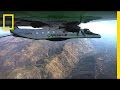
What is the main function of the CAO3 airborne laboratory?
To track animal migration
To map large areas in 3D and analyze tree canopies
To study ocean currents
To monitor air pollution
3.
MULTIPLE CHOICE QUESTION
30 sec • 1 pt
What is the significance of the CAO3's ability to map in 3D?
It helps in urban planning
It provides detailed forest data
It measures air quality
It tracks wildlife movements
4.
MULTIPLE CHOICE QUESTION
30 sec • 1 pt
How does the GRACE mission measure changes in water mass?
By using ground sensors
By analyzing satellite images
By measuring gravitational changes with satellites
By collecting water samples
5.
MULTIPLE CHOICE QUESTION
30 sec • 1 pt
What is the role of the GRACE mission in understanding droughts?
It provides rainfall forecasts
It predicts future droughts
It monitors soil quality
It measures water mass changes to assess drought impact
6.
MULTIPLE CHOICE QUESTION
30 sec • 1 pt
What does the Airborne Snow Observatory use to measure snowpack?
Weather balloons
Thermal cameras
Spectrometers and laser altimeters
Radar systems
7.
MULTIPLE CHOICE QUESTION
30 sec • 1 pt
What percentage of snowmelt energy comes from absorbed sunlight?
70-80%
90-95%
100%
50-60%
Access all questions and much more by creating a free account
Create resources
Host any resource
Get auto-graded reports
Continue with Google

Continue with Email
Continue with Classlink
Continue with Clever
or continue with
Microsoft
%20(1).png)
Apple
Others
Already have an account?
Popular Resources on Wayground

15 questions
Fractions on a Number Line
Quiz
•
3rd Grade
20 questions
Equivalent Fractions
Quiz
•
3rd Grade
25 questions
Multiplication Facts
Quiz
•
5th Grade
54 questions
Analyzing Line Graphs & Tables
Quiz
•
4th Grade
22 questions
fractions
Quiz
•
3rd Grade
20 questions
Main Idea and Details
Quiz
•
5th Grade
20 questions
Context Clues
Quiz
•
6th Grade
15 questions
Equivalent Fractions
Quiz
•
4th Grade
Discover more resources for Science
10 questions
Exploring the Layers of the Earth
Interactive video
•
6th - 10th Grade
25 questions
Naming Ionic and Covalent Compounds
Quiz
•
9th Grade
20 questions
Mendelian Genetics Review
Quiz
•
9th Grade
10 questions
Exploring Weathering, Erosion, and Deposition Processes
Interactive video
•
6th - 10th Grade
21 questions
Evidence of Evolution
Quiz
•
9th Grade
13 questions
Part 3 Review Protein Synthesis and Mutations
Quiz
•
10th Grade
22 questions
Earth's Spheres and Interactions Quiz Reveiw
Quiz
•
8th - 10th Grade
15 questions
Genetics- Punnett Squares
Quiz
•
9th Grade