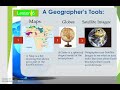
Geographer's Tools
Interactive Video
•
Geography
•
4th - 5th Grade
•
Practice Problem
•
Easy

Patricia Brown
Used 1+ times
FREE Resource
Read more
10 questions
Show all answers
1.
MULTIPLE CHOICE QUESTION
30 sec • 1 pt
What is the primary purpose of geographer's tools?
To entertain people
To provide information and knowledge about the world
To create fictional stories
To design buildings
2.
MULTIPLE CHOICE QUESTION
30 sec • 1 pt
What is a map?
A spherical model of the Earth
A flat drawing showing all or part of Earth's surface
A computer-based mapping technology
A device for measuring geographic coordinates
3.
MULTIPLE CHOICE QUESTION
30 sec • 1 pt
Why are maps important for geographers?
They help in identifying and recognizing areas and places
They are used for cooking
They are used to predict the weather
They provide entertainment
4.
MULTIPLE CHOICE QUESTION
30 sec • 1 pt
What does a globe represent?
A flat drawing of a continent
A spherical model of the entire planet
A tool for drawing maps
A device for measuring temperature
5.
MULTIPLE CHOICE QUESTION
30 sec • 1 pt
How do globes differ from maps?
Globes are flat, maps are spherical
Globes provide a more accurate shape of the Earth
Globes are used for cooking
Maps are more accurate than globes
6.
MULTIPLE CHOICE QUESTION
30 sec • 1 pt
What is the main use of satellite images for geographers?
To design buildings
To entertain people
To predict the weather
To observe changes on Earth and create accurate maps
7.
MULTIPLE CHOICE QUESTION
30 sec • 1 pt
What does GPS stand for?
Global Positioning System
Geographic Positioning System
Global Planning System
Geographic Planning System
Access all questions and much more by creating a free account
Create resources
Host any resource
Get auto-graded reports
Continue with Google

Continue with Email
Continue with Classlink
Continue with Clever
or continue with
Microsoft
%20(1).png)
Apple
Others
Already have an account?
Similar Resources on Wayground

11 questions
Exploring Florida and Beyond
Interactive video
•
5th - 8th Grade
11 questions
Memory and Fruit Recognition in Theatre
Interactive video
•
4th - 8th Grade
9 questions
Travel Experiences and Visual Impairments
Interactive video
•
6th - 8th Grade
11 questions
Animal Behavior and Adaptations
Interactive video
•
5th - 8th Grade
6 questions
I WONDER - What Jobs Do Space Probes Do?
Interactive video
•
KG - 6th Grade
6 questions
I WONDER - What Is The Smallest Continent?
Interactive video
•
6th - 7th Grade
8 questions
Mussel Harvesting in Ireland
Interactive video
•
5th - 8th Grade
6 questions
CLEAN : Tunisia marks uprising anniversary with ri
Interactive video
•
6th - 7th Grade
Popular Resources on Wayground
15 questions
Fractions on a Number Line
Quiz
•
3rd Grade
20 questions
Equivalent Fractions
Quiz
•
3rd Grade
25 questions
Multiplication Facts
Quiz
•
5th Grade
22 questions
fractions
Quiz
•
3rd Grade
20 questions
Main Idea and Details
Quiz
•
5th Grade
20 questions
Context Clues
Quiz
•
6th Grade
15 questions
Equivalent Fractions
Quiz
•
4th Grade
20 questions
Figurative Language Review
Quiz
•
6th Grade
Discover more resources for Geography
50 questions
50 States
Quiz
•
4th - 7th Grade
13 questions
13 Colonies Map
Quiz
•
4th - 6th Grade
10 questions
Latitude & Longitude
Lesson
•
4th Grade
22 questions
Northeast States and Capitals
Quiz
•
5th Grade
40 questions
Flags of the World
Quiz
•
KG - Professional Dev...
21 questions
West States and Capitals
Quiz
•
5th Grade