Decoding Weather Maps: Air Masses and Fronts
Interactive Video
•
Science
•
6th - 10th Grade
•
Practice Problem
•
Medium
Standards-aligned

Jackson Turner
Used 8+ times
FREE Resource
Standards-aligned
10 questions
Show all answers
1.
MULTIPLE CHOICE QUESTION
30 sec • 1 pt
What does an 'H' on a weather map represent?
High pressure
High temperature
High wind speed
High humidity
Tags
NGSS.MS-ESS2-5
2.
MULTIPLE CHOICE QUESTION
30 sec • 1 pt
What type of weather is typically associated with high-pressure areas?
Sunny skies
Stormy weather
Snowy weather
Cloudy skies
Tags
NGSS.MS-ESS2-5
3.
MULTIPLE CHOICE QUESTION
30 sec • 1 pt
In which direction do winds move around a low-pressure area?
Upwards
Downwards
Counterclockwise
Clockwise
Tags
NGSS.MS-ESS2-5
NGSS.MS-ESS2-6
4.
MULTIPLE CHOICE QUESTION
30 sec • 1 pt
What instrument is used to measure air pressure?
Thermometer
Barometer
Hygrometer
Anemometer
5.
MULTIPLE CHOICE QUESTION
30 sec • 1 pt
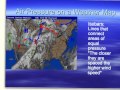
What do closely spaced isobars on a weather map indicate?
High temperature
Low wind speed
High wind speed
Low humidity
Tags
NGSS.MS-ESS2-5
NGSS.MS-ESS2-6
6.
MULTIPLE CHOICE QUESTION
30 sec • 1 pt
What is a front in weather terminology?
A boundary between different air masses
A type of cloud
A high-pressure area
A low-pressure area
Tags
NGSS.MS-ESS2-5
7.
MULTIPLE CHOICE QUESTION
30 sec • 1 pt
Which air mass is characterized by being cold and dry?
Continental tropical
Maritime polar
Continental polar
Maritime tropical
Access all questions and much more by creating a free account
Create resources
Host any resource
Get auto-graded reports
Continue with Google

Continue with Email
Continue with Microsoft
or continue with

%20(1).png)
Apple
Others
Already have an account?
