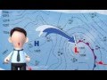
Decoding Weather Maps
Interactive Video
•
Science
•
6th - 10th Grade
•
Practice Problem
•
Hard
Standards-aligned

Mia Campbell
FREE Resource
Standards-aligned
8 questions
Show all answers
1.
MULTIPLE CHOICE QUESTION
30 sec • 1 pt
What do the H's on a weather map represent?
High wind speed
High air pressure
High humidity
High temperature
Tags
NGSS.MS-ESS2-5
2.
MULTIPLE CHOICE QUESTION
30 sec • 1 pt
Which type of weather is generally associated with high air pressure?
Cloudy
Snowy
Stormy
Fair or good
Tags
NGSS.MS-ESS2-5
3.
MULTIPLE CHOICE QUESTION
30 sec • 1 pt
In which direction does air move around a high-pressure area?
Clockwise towards the center
Counterclockwise away from the center
Clockwise away from the center
Counterclockwise towards the center
Tags
NGSS.MS-ESS2-5
NGSS.MS-ESS2-6
4.
MULTIPLE CHOICE QUESTION
30 sec • 1 pt
What does a blue line with points on a weather map indicate?
Stationary front
Cold front
Warm front
Occluded front
5.
MULTIPLE CHOICE QUESTION
30 sec • 1 pt
What do the points on a cold front symbol show?
Direction of warm air movement
Direction of cold air movement
Location of low pressure
Location of high pressure
Tags
NGSS.MS-ESS2-5
NGSS.MS-ESS2-6
6.
MULTIPLE CHOICE QUESTION
30 sec • 1 pt
What does a line with alternating cold and warm front symbols represent?
Occluded front
Stationary front
Warm front
Cold front
7.
MULTIPLE CHOICE QUESTION
30 sec • 1 pt
What does a purple line with cold and warm front symbols on the same side indicate?
Warm front
Cold front
Stationary front
Occluded front
Access all questions and much more by creating a free account
Create resources
Host any resource
Get auto-graded reports
Continue with Google

Continue with Email
Continue with Classlink
Continue with Clever
or continue with
Microsoft
%20(1).png)
Apple
Others
Already have an account?
Popular Resources on Wayground

15 questions
Fractions on a Number Line
Quiz
•
3rd Grade
20 questions
Equivalent Fractions
Quiz
•
3rd Grade
25 questions
Multiplication Facts
Quiz
•
5th Grade
22 questions
fractions
Quiz
•
3rd Grade
20 questions
Main Idea and Details
Quiz
•
5th Grade
20 questions
Context Clues
Quiz
•
6th Grade
15 questions
Equivalent Fractions
Quiz
•
4th Grade
20 questions
Figurative Language Review
Quiz
•
6th Grade
Discover more resources for Science
33 questions
Grade 6 Quarter 3 PMA 5 Review
Quiz
•
6th - 8th Grade
85 questions
Midpoint D1 Review
Quiz
•
8th Grade
20 questions
Rocks and The Rock Cycle
Quiz
•
6th Grade
12 questions
Ecological Succession
Quiz
•
7th Grade
12 questions
Newton's Laws of Motion
Lesson
•
6th - 8th Grade
10 questions
Exploring the Rock Cycle: Types and Formation
Interactive video
•
6th - 8th Grade
10 questions
Exploring the Layers of the Earth
Interactive video
•
6th - 10th Grade
20 questions
Pure Substances & Mixtures
Quiz
•
8th Grade