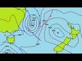
Decoding Weather Maps and Isoline Concepts
Interactive Video
•
Science
•
6th - 10th Grade
•
Practice Problem
•
Medium
Standards-aligned

Aiden Montgomery
Used 6+ times
FREE Resource
Standards-aligned
Read more
10 questions
Show all answers
1.
MULTIPLE CHOICE QUESTION
30 sec • 1 pt
What is another name for weather maps?
Pressure chart
Topographic chart
Isobar map
Synoptic chart
2.
MULTIPLE CHOICE QUESTION
30 sec • 1 pt
What unit do most meteorologists use to measure atmospheric pressure?
Pascal
Bar
Hectopascal
Millibar
3.
MULTIPLE CHOICE QUESTION
30 sec • 1 pt
What symbol is used to identify areas of high pressure on a weather map?
H
A
L
P
4.
MULTIPLE CHOICE QUESTION
30 sec • 1 pt
What weather conditions are associated with areas of low pressure?
Clear skies and little wind
Sunny and dry
Snow and ice
Rain, clouds, and high winds
Tags
NGSS.MS-ESS2-5
5.
MULTIPLE CHOICE QUESTION
30 sec • 1 pt
What does a cold front represent on a weather map?
A boundary where two air masses are not moving
A boundary where a cold air mass pushes underneath a warm air mass
A boundary where a warm air mass overtakes a cold air mass
A boundary where a warm air mass pushes underneath a cold air mass
Tags
NGSS.MS-ESS2-5
NGSS.MS-ESS2-6
6.
MULTIPLE CHOICE QUESTION
30 sec • 1 pt
How is a warm front represented on a weather map?
A purple line with triangles and semi-circles
An alternating warm and cold front symbols
A red line with semi-circles
A blue line with triangles
7.
MULTIPLE CHOICE QUESTION
30 sec • 1 pt
What is a stationary front?
A boundary where a cold air mass pushes underneath a warm air mass
A boundary where a warm air mass overtakes a cold air mass
A boundary between two air masses that are not moving
A composite of two frontal systems that merge
Tags
NGSS.MS-ESS2-5
Access all questions and much more by creating a free account
Create resources
Host any resource
Get auto-graded reports
Continue with Google

Continue with Email
Continue with Microsoft
or continue with

%20(1).png)
Apple
Others
Already have an account?
