Exploring Different Types of Maps
Interactive Video
•
Social Studies
•
6th - 10th Grade
•
Practice Problem
•
Easy

Sophia Harris
Used 17+ times
FREE Resource
Read more
10 questions
Show all answers
1.
MULTIPLE CHOICE QUESTION
30 sec • 1 pt
What are the main learning objectives for students in this video?
To understand the history of map-making
To memorize the names of all countries
To identify and describe various types of maps and explain their practical uses
To draw different types of maps
2.
MULTIPLE CHOICE QUESTION
30 sec • 1 pt
What type of information do political maps primarily show?
Natural resources
Boundaries of cities, countries, and states
Physical features
Climate patterns
3.
MULTIPLE CHOICE QUESTION
30 sec • 1 pt
How are political maps usually colored?
By elevation
By climate zones
By population density
By country or state
4.
MULTIPLE CHOICE QUESTION
30 sec • 1 pt
What do physical maps primarily display?
Political boundaries
Economic activities
Population distribution
Physical features such as landforms and bodies of water
5.
MULTIPLE CHOICE QUESTION
30 sec • 1 pt
What do the colors on a physical map represent?
Climate zones
Population density
Political boundaries
Types of vegetation, mountains, and natural features
6.
MULTIPLE CHOICE QUESTION
30 sec • 1 pt
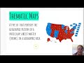
What is the primary purpose of thematic maps?
To show elevation
To display physical features
To show political boundaries
To portray geographical patterns of specific themes or topics
7.
MULTIPLE CHOICE QUESTION
30 sec • 1 pt
Who commonly uses thematic maps?
Artists
Tourists
Hikers and geologists
Researchers, planners, and policy makers
Access all questions and much more by creating a free account
Create resources
Host any resource
Get auto-graded reports
Continue with Google

Continue with Email
Continue with Microsoft
or continue with

%20(1).png)
Apple
Others
Already have an account?
