Exploring Various Online Map Types
Interactive Video
•
English
•
6th - 10th Grade
•
Practice Problem
•
Medium

Ethan Morris
Used 3+ times
FREE Resource
10 questions
Show all answers
1.
MULTIPLE CHOICE QUESTION
30 sec • 1 pt
What do physical maps primarily show?
Climate conditions
Political boundaries
Population density
Natural landforms and bodies of water
2.
MULTIPLE CHOICE QUESTION
30 sec • 1 pt
Which of the following is NOT typically shown on a physical map?
Lakes
State boundaries
Rivers
Mountains
3.
MULTIPLE CHOICE QUESTION
30 sec • 1 pt
What information do elevation maps provide?
Climate conditions
Political boundaries
Height above sea level
Population density
4.
MULTIPLE CHOICE QUESTION
30 sec • 1 pt
On an elevation map, what does the color green typically represent?
Low elevation
Political boundaries
Population density
High elevation
5.
MULTIPLE CHOICE QUESTION
30 sec • 1 pt
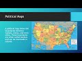
What do political maps primarily show?
Climate conditions
Natural landforms
Boundaries between nations, states, and cities
Population density
6.
MULTIPLE CHOICE QUESTION
30 sec • 1 pt
Which of the following can be a physical boundary on a political map?
A river
A city
A country name
A state line
7.
MULTIPLE CHOICE QUESTION
30 sec • 1 pt
What do population maps help us understand?
Political boundaries
Natural resources
Climate conditions
Overall population of a particular area
Access all questions and much more by creating a free account
Create resources
Host any resource
Get auto-graded reports
Continue with Google

Continue with Email
Continue with Classlink
Continue with Clever
or continue with
Microsoft
%20(1).png)
Apple
Others
Already have an account?
Popular Resources on Wayground

15 questions
Fractions on a Number Line
Quiz
•
3rd Grade
20 questions
Equivalent Fractions
Quiz
•
3rd Grade
25 questions
Multiplication Facts
Quiz
•
5th Grade
54 questions
Analyzing Line Graphs & Tables
Quiz
•
4th Grade
22 questions
fractions
Quiz
•
3rd Grade
20 questions
Main Idea and Details
Quiz
•
5th Grade
20 questions
Context Clues
Quiz
•
6th Grade
15 questions
Equivalent Fractions
Quiz
•
4th Grade
Discover more resources for English
20 questions
Context Clues
Quiz
•
6th Grade
20 questions
Figurative Language Review
Quiz
•
6th Grade
15 questions
Making Inferences
Quiz
•
7th - 12th Grade
20 questions
Main Idea and Supporting Details
Quiz
•
7th Grade
15 questions
Main Idea and Supporting Details.
Quiz
•
4th - 11th Grade
24 questions
7th grade STAAR Reading Review
Quiz
•
7th Grade
15 questions
6th Context Clues
Quiz
•
6th Grade
20 questions
Figurative Language Review
Quiz
•
8th Grade