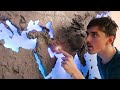
3D Printed Map Features and Challenges
Interactive Video
•
Geography, Design, Computers
•
7th - 12th Grade
•
Practice Problem
•
Hard

Liam Anderson
FREE Resource
Read more
10 questions
Show all answers
1.
MULTIPLE CHOICE QUESTION
30 sec • 1 pt
What is the main feature of the 3D printed world map introduced in the video?
It is made entirely of wood.
It includes topographic terrain.
It is a flat map with no elevation.
It is a digital map.
2.
MULTIPLE CHOICE QUESTION
30 sec • 1 pt
How long did it take to print the largest piece of the map?
24 hours
12 hours
48 hours
72 hours
3.
MULTIPLE CHOICE QUESTION
30 sec • 1 pt
What software was used to scale and section the map model?
SketchUp
AutoCAD
Fusion 360
Blender
4.
MULTIPLE CHOICE QUESTION
30 sec • 1 pt
Which map projection is used in the video that differs from the Mercator projection?
Robinson projection
Birdman projection
Mollweide projection
Gall-Peters projection
5.
MULTIPLE CHOICE QUESTION
30 sec • 1 pt
What is a challenge mentioned about representing a globe on a 2D surface?
It is impossible to maintain accurate distances.
It requires a lot of colors.
It cannot show any topography.
It involves stretching or compromising certain areas.
6.
MULTIPLE CHOICE QUESTION
30 sec • 1 pt
What issue was encountered with the double-sided tape during the map assembly?
It was too sticky.
It was not sticky enough.
It was too expensive.
It was not available.
7.
MULTIPLE CHOICE QUESTION
30 sec • 1 pt
What is the purpose of the tiny LEDs used in the map?
To indicate mountain ranges.
To show country borders.
To highlight rivers.
To mark capitals and large cities.
Access all questions and much more by creating a free account
Create resources
Host any resource
Get auto-graded reports
Continue with Google

Continue with Email
Continue with Microsoft
or continue with

%20(1).png)
Apple
Others
Already have an account?
