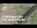
Understanding Solar Eclipse Maps
Interactive Video
•
Science, Geography
•
5th - 8th Grade
•
Practice Problem
•
Hard

Amelia Wright
FREE Resource
Read more
5 questions
Show all answers
1.
MULTIPLE CHOICE QUESTION
30 sec • 1 pt
What tool does NASA provide to help decide where to view the 2024 total solar eclipse?
A weather forecast
A travel guide
A telescope rental service
An eclipse map
2.
MULTIPLE CHOICE QUESTION
30 sec • 1 pt
What does the dark band across North America represent on the eclipse map?
The path of the partial eclipse
The path of the total eclipse
The path of the lunar eclipse
The path of the solar wind
3.
MULTIPLE CHOICE QUESTION
30 sec • 1 pt
What do the oval shapes with times listed inside the dark path indicate?
The time of sunrise
The time of the total eclipse
The time of sunset
The duration of the eclipse
4.
MULTIPLE CHOICE QUESTION
30 sec • 1 pt
What do the white lines inside the path of the eclipse indicate?
The duration of totality
The start of the eclipse
The end of the eclipse
The path of the Moon
5.
MULTIPLE CHOICE QUESTION
30 sec • 1 pt
What do the purple lines outside the path indicate?
The amount of the Moon visible
The path of the solar wind
The amount of the Sun covered during the partial eclipse
The duration of the total eclipse
Access all questions and much more by creating a free account
Create resources
Host any resource
Get auto-graded reports
Continue with Google

Continue with Email
Continue with Classlink
Continue with Clever
or continue with
Microsoft
%20(1).png)
Apple
Others
Already have an account?
Similar Resources on Wayground
Popular Resources on Wayground

15 questions
Fractions on a Number Line
Quiz
•
3rd Grade
20 questions
Equivalent Fractions
Quiz
•
3rd Grade
25 questions
Multiplication Facts
Quiz
•
5th Grade
54 questions
Analyzing Line Graphs & Tables
Quiz
•
4th Grade
22 questions
fractions
Quiz
•
3rd Grade
20 questions
Main Idea and Details
Quiz
•
5th Grade
20 questions
Context Clues
Quiz
•
6th Grade
15 questions
Equivalent Fractions
Quiz
•
4th Grade
Discover more resources for Science
20 questions
The Water Cycle
Quiz
•
5th Grade
20 questions
Cell Organelles and Functions
Quiz
•
6th - 8th Grade
33 questions
Grade 6 Quarter 3 PMA 5 Review
Quiz
•
6th - 8th Grade
20 questions
Rocks and The Rock Cycle
Quiz
•
6th Grade
20 questions
Weathering, Erosion, Deposition
Quiz
•
5th Grade
20 questions
Food Chains and Food Webs Review
Quiz
•
5th Grade
28 questions
4th Grade The Need for Speed
Quiz
•
3rd - 5th Grade
12 questions
Ecological Succession
Quiz
•
7th Grade