Canada-US Border Issues and Features
Interactive Video
•
Geography, History
•
9th - 12th Grade
•
Practice Problem
•
Medium

Lucas Foster
Used 2+ times
FREE Resource
Read more
10 questions
Show all answers
1.
MULTIPLE CHOICE QUESTION
30 sec • 1 pt
What is the unique feature of the Canada-US border?
It is the most populated border.
It is the shortest border in the world.
It has a 20-foot wide no-touching zone.
It is the most mountainous border.
2.
MULTIPLE CHOICE QUESTION
30 sec • 1 pt
Why is the Canada-US border not perfectly straight?
It was surveyed with limited tools in the 1800s.
It follows natural landmarks like rivers.
It was drawn using modern GPS technology.
It was intentionally designed to be zig-zag.
3.
MULTIPLE CHOICE QUESTION
30 sec • 1 pt
How many monuments were placed to mark the Canada-US border?
More than 10,000
Exactly 1000
Over 900
Less than 500
4.
MULTIPLE CHOICE QUESTION
30 sec • 1 pt
What is the main issue with the disputed islands between the US and Canada?
They are strategically important for military purposes.
They are popular with tourists and fishermen.
They are rich in natural resources.
They are heavily populated.
5.
MULTIPLE CHOICE QUESTION
30 sec • 1 pt
What caused the border irregularities between the US and Canada?
Historical map inaccuracies
Recent political agreements
Natural disasters
Technological advancements
6.
MULTIPLE CHOICE QUESTION
30 sec • 1 pt
What was the problem with the map used during the 1783 negotiations?
It was too detailed.
It had an inset covering the area in question.
It was missing the East Coast.
It was drawn by the British.
7.
MULTIPLE CHOICE QUESTION
30 sec • 1 pt
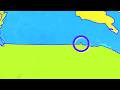
What was the solution for the border issue with Vancouver Island?
The border was adjusted to swoop around the island.
The island was divided between the US and Canada.
The island was declared a neutral zone.
The border was drawn straight through the island.
Access all questions and much more by creating a free account
Create resources
Host any resource
Get auto-graded reports
Continue with Google

Continue with Email
Continue with Classlink
Continue with Clever
or continue with
Microsoft
%20(1).png)
Apple
Others
Already have an account?
Popular Resources on Wayground

15 questions
Fractions on a Number Line
Quiz
•
3rd Grade
20 questions
Equivalent Fractions
Quiz
•
3rd Grade
25 questions
Multiplication Facts
Quiz
•
5th Grade
29 questions
Alg. 1 Section 5.1 Coordinate Plane
Quiz
•
9th Grade
22 questions
fractions
Quiz
•
3rd Grade
11 questions
FOREST Effective communication
Lesson
•
KG
20 questions
Main Idea and Details
Quiz
•
5th Grade
20 questions
Context Clues
Quiz
•
6th Grade