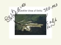
Understanding Satellite Views
Interactive Video
•
Science, Geography
•
5th - 8th Grade
•
Practice Problem
•
Hard

Jackson Turner
FREE Resource
Read more
10 questions
Show all answers
1.
MULTIPLE CHOICE QUESTION
30 sec • 1 pt
What is the primary purpose of using satellites to take images of Earth's surface?
To track animal migration patterns
To monitor air pollution levels
To measure the temperature of the atmosphere
To observe changes in the planet's surface
2.
MULTIPLE CHOICE QUESTION
30 sec • 1 pt
What natural process is responsible for the erosion of volcanic mountains?
Earthquakes
Weathering from rain and wind
Volcanic eruptions
Tectonic plate movements
3.
MULTIPLE CHOICE QUESTION
30 sec • 1 pt
What feature indicates that a volcano is active in a satellite image?
Vegetation on the slopes
Presence of snow caps
A plume of ash
Surrounding water bodies
4.
MULTIPLE CHOICE QUESTION
30 sec • 1 pt
Why is it difficult to determine the elevation of mountains from satellite images?
Mountains are surrounded by water
The images are in black and white
Mountains are covered by clouds
The images are taken from too high up
5.
MULTIPLE CHOICE QUESTION
30 sec • 1 pt
What geological process is responsible for the formation of the Himalayan Mountains?
Volcanic activity
Erosion by rivers
Deposition of sediments
Convergence of tectonic plates
6.
MULTIPLE CHOICE QUESTION
30 sec • 1 pt
What is a delta, as described in the lesson?
A desert area with little vegetation
A volcanic island surrounded by water
A mountain range formed by tectonic activity
A landform created by sediment deposition at a river's mouth
7.
MULTIPLE CHOICE QUESTION
30 sec • 1 pt
What are the brown patches in a delta region indicative of?
Volcanic ash deposits
Areas of deforestation
Sediments from weathered rocks
Dried up riverbeds
Access all questions and much more by creating a free account
Create resources
Host any resource
Get auto-graded reports
Continue with Google

Continue with Email
Continue with Classlink
Continue with Clever
or continue with
Microsoft
%20(1).png)
Apple
Others
Already have an account?
Popular Resources on Wayground

15 questions
Fractions on a Number Line
Quiz
•
3rd Grade
20 questions
Equivalent Fractions
Quiz
•
3rd Grade
25 questions
Multiplication Facts
Quiz
•
5th Grade
29 questions
Alg. 1 Section 5.1 Coordinate Plane
Quiz
•
9th Grade
22 questions
fractions
Quiz
•
3rd Grade
11 questions
FOREST Effective communication
Lesson
•
KG
20 questions
Main Idea and Details
Quiz
•
5th Grade
20 questions
Context Clues
Quiz
•
6th Grade
Discover more resources for Science
22 questions
Phases of the moon
Quiz
•
8th Grade
12 questions
Structures and Functions
Quiz
•
3rd - 5th Grade
20 questions
Rocks and The Rock Cycle
Quiz
•
6th Grade
20 questions
Weathering, Erosion, Deposition
Quiz
•
5th Grade
20 questions
Food Chains and Food Webs Review
Quiz
•
5th Grade
15 questions
Rock Cycle
Quiz
•
6th Grade
17 questions
5.9B Food Chain & Food Web 2.0
Quiz
•
5th Grade
10 questions
Exploring the Rock Cycle
Interactive video
•
6th - 8th Grade