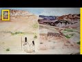
Understanding Zuni Knowledge and Mapping
Interactive Video
•
Geography, History, Arts, Social Studies, Religious Studies
•
9th - 12th Grade
•
Practice Problem
•
Hard

Liam Anderson
FREE Resource
Read more
10 questions
Show all answers
1.
MULTIPLE CHOICE QUESTION
30 sec • 1 pt
What is the main idea introduced in the first section of the video?
The role of technology in modern mapping.
The history of cartography.
The underestimated knowledge of the Zuni people.
The importance of traditional maps.
2.
MULTIPLE CHOICE QUESTION
30 sec • 1 pt
What does Jim Enote emphasize about his personal history?
His education in cartography.
His career as a museum director.
His lifelong connection to farming and planting.
His travels around the world.
3.
MULTIPLE CHOICE QUESTION
30 sec • 1 pt
What is the purpose of the map art introduced by Jim Enote?
To create aesthetically pleasing maps.
To challenge traditional notions of mapping.
To replace Google Maps.
To document global geography.
4.
MULTIPLE CHOICE QUESTION
30 sec • 1 pt
What challenge does Jim Enote identify with traditional maps?
They are difficult to read.
They are expensive to produce.
They are too detailed.
They often lead to the loss of native lands.
5.
MULTIPLE CHOICE QUESTION
30 sec • 1 pt
What is a unique feature of the Zuni map art?
It is written in multiple languages.
It is only available online.
It does not require North to be at the top.
It uses only black and white colors.
6.
MULTIPLE CHOICE QUESTION
30 sec • 1 pt
What does Jim Enote's mother say about aerial photos?
They are confusing because she is not a bird.
They are beautiful.
They are easy to understand.
They are very informative.
7.
MULTIPLE CHOICE QUESTION
30 sec • 1 pt
How do the Zuni people traditionally convey geographical knowledge?
Through written documents.
Through oral stories only.
Through songs, prayers, and symbols.
Through digital maps.
Access all questions and much more by creating a free account
Create resources
Host any resource
Get auto-graded reports
Continue with Google

Continue with Email
Continue with Classlink
Continue with Clever
or continue with
Microsoft
%20(1).png)
Apple
Others
Already have an account?
