Dinosaur Trackways and LiDAR Technology
Interactive Video
•
Science, Geography, History
•
7th - 12th Grade
•
Practice Problem
•
Hard

Aiden Montgomery
FREE Resource
Read more
10 questions
Show all answers
1.
MULTIPLE CHOICE QUESTION
30 sec • 1 pt
What is Phil's main objective at the dinosaur site in Northern Spain?
To study the climate of the past
To find new dinosaur species
To understand how dinosaurs moved
To collect dinosaur fossils
2.
MULTIPLE CHOICE QUESTION
30 sec • 1 pt
What has changed in the neighborhood of the dinosaur site over 70 million years?
It has turned into a lake
It has become a forest
It has turned into a mountain range
It has become a desert
3.
MULTIPLE CHOICE QUESTION
30 sec • 1 pt
How were the dinosaur footprints preserved over millions of years?
Through human intervention
By volcanic ash covering them
Through layers of mud and sand
By being frozen in ice
4.
MULTIPLE CHOICE QUESTION
30 sec • 1 pt
What challenge does Phil face when mapping the dinosaur footprints?
The tracks are underwater
The tracks are covered by vegetation
The tracks are fragile and break easily
The tracks are too deep to measure
5.
MULTIPLE CHOICE QUESTION
30 sec • 1 pt
What is the role of Dr. Bernard V in the project?
He is a geologist
He is a paleontologist
He is a biologist
He is a historian
6.
MULTIPLE CHOICE QUESTION
30 sec • 1 pt
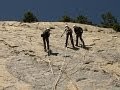
What does Phil feel when he is about to be lowered off the cliff?
Indifferent
Nervous
Confident
Excited
7.
MULTIPLE CHOICE QUESTION
30 sec • 1 pt
Why does Phil believe the dinosaur trackways will be lost in a decade?
Due to volcanic activity
Because of theft
Because of natural erosion
Due to urban development
Access all questions and much more by creating a free account
Create resources
Host any resource
Get auto-graded reports
Continue with Google

Continue with Email
Continue with Microsoft
or continue with

%20(1).png)
Apple
Others
Already have an account?
