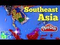
Play-Doh Mapping Southeast Asia Through Colorful Creativity
Interactive Video
•
Geography, Arts, Fun
•
3rd - 5th Grade
•
Practice Problem
•
Hard

Patricia Brown
FREE Resource
Read more
10 questions
Show all answers
1.
MULTIPLE CHOICE QUESTION
30 sec • 1 pt
What is the main focus of the Play-Doh map activity in this video?
The entire world
Southeast Asia
Europe
The United States
2.
MULTIPLE CHOICE QUESTION
30 sec • 1 pt
Which country is placed first on the Play-Doh map?
India
Myanmar
Bangladesh
Nepal
3.
MULTIPLE CHOICE QUESTION
30 sec • 1 pt
What was Myanmar previously known as?
Indochina
Ceylon
Burma
Siam
4.
MULTIPLE CHOICE QUESTION
30 sec • 1 pt
Which country is represented by a silver Play-Doh piece?
Laos
Cambodia
Vietnam
Taiwan
5.
MULTIPLE CHOICE QUESTION
30 sec • 1 pt
What is the significance of the different colors of the islands in the Play-Doh map?
They show different time zones
They indicate different countries
They represent different climates
They highlight different cultures
6.
MULTIPLE CHOICE QUESTION
30 sec • 1 pt
Which two countries are connected to the mainland in the Play-Doh map?
Laos and Cambodia
Indonesia and the Philippines
Malaysia and Singapore
Thailand and Vietnam
7.
MULTIPLE CHOICE QUESTION
30 sec • 1 pt
Which island in Indonesia did Gabrielle and Elise's parents visit?
Java
Sumatra
Bali
Lombok
Access all questions and much more by creating a free account
Create resources
Host any resource
Get auto-graded reports
Continue with Google

Continue with Email
Continue with Classlink
Continue with Clever
or continue with
Microsoft
%20(1).png)
Apple
Others
Already have an account?
