Mapping Our World: Unveiling the Secrets of Geography and Navigation
Interactive Video
•
Geography, Science, History
•
3rd - 5th Grade
•
Practice Problem
•
Hard

Patricia Brown
FREE Resource
Read more
10 questions
Show all answers
1.
MULTIPLE CHOICE QUESTION
30 sec • 1 pt
Why are maps considered important tools in modern navigation?
They help in finding locations without getting lost.
They provide real-time traffic updates.
They offer weather forecasts.
They can predict future events.
2.
MULTIPLE CHOICE QUESTION
30 sec • 1 pt
What is a map primarily used for?
To provide a graphic representation of the Earth's surface.
To predict weather patterns.
To display historical events.
To show live satellite images.
3.
MULTIPLE CHOICE QUESTION
30 sec • 1 pt
Which of the following is NOT a type of map mentioned in the video?
Astronomical Map
Tourist Map
Climate Map
Hydrographic Map
4.
MULTIPLE CHOICE QUESTION
30 sec • 1 pt
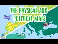
What do political maps primarily show?
Division of continents, countries, and cities
Historical events
Natural resources
Weather patterns
5.
MULTIPLE CHOICE QUESTION
30 sec • 1 pt
What unique feature do physical maps have compared to political maps?
They show the division of countries.
They display natural features like mountains and rivers.
They highlight historical landmarks.
They provide climate data.
6.
MULTIPLE CHOICE QUESTION
30 sec • 1 pt
What is the significance of the Amazon River on physical maps?
It is a major river full of piranhas and caymans.
It is a historical landmark.
It is the longest river in the world.
It is the only river shown on maps.
7.
MULTIPLE CHOICE QUESTION
30 sec • 1 pt
What is the purpose of a compass rose on a map?
To display the map's legend
To show the scale of the map
To highlight important landmarks
To indicate the cardinal directions
Access all questions and much more by creating a free account
Create resources
Host any resource
Get auto-graded reports
Continue with Google

Continue with Email
Continue with Classlink
Continue with Clever
or continue with
Microsoft
%20(1).png)
Apple
Others
Already have an account?
Similar Resources on Wayground
Popular Resources on Wayground

15 questions
Fractions on a Number Line
Quiz
•
3rd Grade
20 questions
Equivalent Fractions
Quiz
•
3rd Grade
25 questions
Multiplication Facts
Quiz
•
5th Grade
54 questions
Analyzing Line Graphs & Tables
Quiz
•
4th Grade
22 questions
fractions
Quiz
•
3rd Grade
20 questions
Main Idea and Details
Quiz
•
5th Grade
20 questions
Context Clues
Quiz
•
6th Grade
15 questions
Equivalent Fractions
Quiz
•
4th Grade