Map Reading and Cartography Concepts
Interactive Video
•
Geography, Science, Social Studies
•
5th - 6th Grade
•
Practice Problem
•
Hard

Patricia Brown
FREE Resource
Read more
10 questions
Show all answers
1.
MULTIPLE CHOICE QUESTION
30 sec • 1 pt
What is the science of map making called?
Geology
Geography
Cartography
Topography
2.
MULTIPLE CHOICE QUESTION
30 sec • 1 pt
What is an atlas?
A type of thematic map
A map showing only continents
A large wall map
A book of maps
3.
MULTIPLE CHOICE QUESTION
30 sec • 1 pt
Which type of map would you use to find the location of a city?
Physical map
Climate map
Political map
Thematic map
4.
MULTIPLE CHOICE QUESTION
30 sec • 1 pt
Which type of map would show the distribution of rainfall?
Thematic map
Topographic map
Physical map
Political map
5.
MULTIPLE CHOICE QUESTION
30 sec • 1 pt
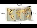
What are the four major directions on a map known as?
Primary directions
Secondary directions
Cardinal directions
Intermediate directions
6.
MULTIPLE CHOICE QUESTION
30 sec • 1 pt
What direction is at the top of a map when it is placed correctly?
South
East
West
North
7.
MULTIPLE CHOICE QUESTION
30 sec • 1 pt
If 1 cm on a map represents 1 km on the ground, what is this ratio called?
Scale of the map
Map distance
Linear scale
Distance ratio
Access all questions and much more by creating a free account
Create resources
Host any resource
Get auto-graded reports
Continue with Google

Continue with Email
Continue with Classlink
Continue with Clever
or continue with
Microsoft
%20(1).png)
Apple
Others
Already have an account?
