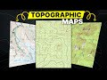
Topographic Map Concepts
Interactive Video
•
Geography, Science, Mathematics
•
6th - 8th Grade
•
Practice Problem
•
Hard

Patricia Brown
FREE Resource
Read more
10 questions
Show all answers
1.
MULTIPLE CHOICE QUESTION
30 sec • 1 pt
What do contour lines on a topographic map represent?
The weather patterns in a region
The terrain and elevation changes
The population density of a region
The type of vegetation in an area
2.
MULTIPLE CHOICE QUESTION
30 sec • 1 pt
What do concentric circles on a topographic map indicate?
Dense forests
Rivers or streams
Hills or peaks
Flat areas
3.
MULTIPLE CHOICE QUESTION
30 sec • 1 pt
How are index lines different from regular contour lines?
They show the direction of the wind
They represent water bodies
They are labeled with elevation values
They are drawn thinner and lighter
4.
MULTIPLE CHOICE QUESTION
30 sec • 1 pt
What does a contour interval of 80 feet mean?
The map is drawn at a scale of 1:80
Each contour line represents an 80-foot distance
There is an 80-foot elevation change between contour lines
The map covers an area of 80 square feet
5.
MULTIPLE CHOICE QUESTION
30 sec • 1 pt
What does the legend of a topographic map help you understand?
The map's scale and symbols
The historical significance of the area
The weather forecast
The population density
6.
MULTIPLE CHOICE QUESTION
30 sec • 1 pt
What is the significance of magnetic declination on a map?
It measures the distance between two points
It helps align a compass with true north
It shows the elevation change
It indicates the type of vegetation
7.
MULTIPLE CHOICE QUESTION
30 sec • 1 pt
What does a 1 to 24,000 map scale mean?
One inch on the map equals 24,000 inches on the ground
The map covers 24,000 square miles
The map is 24,000 times smaller than the actual area
The map shows 24,000 different features
Access all questions and much more by creating a free account
Create resources
Host any resource
Get auto-graded reports
Continue with Google

Continue with Email
Continue with Classlink
Continue with Clever
or continue with
Microsoft
%20(1).png)
Apple
Others
Already have an account?
Similar Resources on Wayground

11 questions
Understanding Angles and Clock Angles
Interactive video
•
5th - 8th Grade
11 questions
Understanding Negative Numbers
Interactive video
•
5th - 8th Grade
11 questions
Geography Concepts and Climate Types
Interactive video
•
5th - 8th Grade
8 questions
Archaeological Discoveries and Mysteries
Interactive video
•
5th - 8th Grade
6 questions
Vicksburg and Camels in History
Interactive video
•
5th - 8th Grade
11 questions
Exploring Phelps and Beyond
Interactive video
•
5th - 8th Grade
11 questions
Reflection Laws and Experimental Setup
Interactive video
•
5th - 8th Grade
11 questions
The True Story of Christopher Columbus
Interactive video
•
5th - 8th Grade
Popular Resources on Wayground
15 questions
Fractions on a Number Line
Quiz
•
3rd Grade
20 questions
Equivalent Fractions
Quiz
•
3rd Grade
25 questions
Multiplication Facts
Quiz
•
5th Grade
22 questions
fractions
Quiz
•
3rd Grade
20 questions
Main Idea and Details
Quiz
•
5th Grade
20 questions
Context Clues
Quiz
•
6th Grade
15 questions
Equivalent Fractions
Quiz
•
4th Grade
20 questions
Figurative Language Review
Quiz
•
6th Grade
Discover more resources for Geography
20 questions
Plate Tectonics and Earth's Structure
Quiz
•
6th Grade
21 questions
Continents and Oceans
Quiz
•
6th Grade
28 questions
SE Asia Government and Economic Systems Review
Quiz
•
7th Grade
20 questions
European Countries
Quiz
•
6th Grade
16 questions
SS7G3 Africa's Population and Trade
Quiz
•
7th Grade
10 questions
China Vocabulary 2025
Quiz
•
7th Grade
14 questions
Latin America Geography Unit Test Study Guide Academic
Quiz
•
6th Grade
10 questions
Africa History Quiz
Quiz
•
6th - 8th Grade