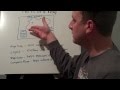
Understanding Maps and Directions
Interactive Video
•
Geography
•
4th - 5th Grade
•
Practice Problem
•
Hard

Patricia Brown
FREE Resource
Read more
10 questions
Show all answers
1.
MULTIPLE CHOICE QUESTION
30 sec • 1 pt
What are the main topics covered in this lesson?
Latitude, Longitude, Parts of a Map, Directions
Weather, Climate, Seasons, Time Zones
Countries, Capitals, Languages, Currencies
Rivers, Mountains, Deserts, Oceans
2.
MULTIPLE CHOICE QUESTION
30 sec • 1 pt
How are lines of latitude described?
Horizontal lines that run parallel to each other
Diagonal lines that intersect at the equator
Vertical lines that run from pole to pole
Curved lines that circle the globe
3.
MULTIPLE CHOICE QUESTION
30 sec • 1 pt
What is the characteristic of longitude lines?
They are horizontal and parallel
They are vertical and meet at the poles
They are diagonal and cross each other
They are curved and never meet
4.
MULTIPLE CHOICE QUESTION
30 sec • 1 pt
What is the purpose of a map's legend?
To provide a scale for measuring distances
To list and explain the symbols used on the map
To show the map's title and subject
To indicate the map's orientation
5.
MULTIPLE CHOICE QUESTION
30 sec • 1 pt
How does a map scale help users?
By measuring distances on the map
By listing the symbols used on the map
By showing the map's orientation
By providing the map's title
6.
MULTIPLE CHOICE QUESTION
30 sec • 1 pt
What is the function of a compass rose on a map?
To show the map's title
To indicate the map's scale
To help identify directions
To list the map's symbols
7.
MULTIPLE CHOICE QUESTION
30 sec • 1 pt
Which of the following is a cardinal direction?
Southeast
North
Southwest
Northeast
Access all questions and much more by creating a free account
Create resources
Host any resource
Get auto-graded reports
Continue with Google

Continue with Email
Continue with Classlink
Continue with Clever
or continue with
Microsoft
%20(1).png)
Apple
Others
Already have an account?
