Thematic and Proportional Maps Concepts
Interactive Video
•
Geography, Social Studies, Design
•
9th - 12th Grade
•
Practice Problem
•
Hard

Patricia Brown
FREE Resource
Read more
10 questions
Show all answers
1.
MULTIPLE CHOICE QUESTION
30 sec • 1 pt
What is the primary purpose of thematic maps?
To assist in navigation
To show historical events
To depict physical landscapes
To represent data spatially by themes
2.
MULTIPLE CHOICE QUESTION
30 sec • 1 pt
What is a common issue with choropleth maps?
They require 3D glasses
They are difficult to read
They generalize data within reporting units
They are too colorful
3.
MULTIPLE CHOICE QUESTION
30 sec • 1 pt
How do proportional symbol maps represent data?
By showing historical timelines
By varying the size of symbols
By using different colors
By using 3D models
4.
MULTIPLE CHOICE QUESTION
30 sec • 1 pt
What is a potential problem with proportional symbol maps?
They are too simple
They can overlap and obscure data
They are not colorful enough
They require special software
5.
MULTIPLE CHOICE QUESTION
30 sec • 1 pt
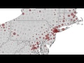
In dot density maps, what does each dot typically represent?
A specific location
A random point within a boundary
A historical event
A weather pattern
6.
MULTIPLE CHOICE QUESTION
30 sec • 1 pt
Why is transparency important in dot density maps?
To reduce the map's size
To add more colors
To prevent misinterpretation of data points as exact locations
To make the map look better
7.
MULTIPLE CHOICE QUESTION
30 sec • 1 pt
What is a divergent color scheme commonly used for?
To display historical timelines
To highlight geographical features
To depict political trends
To show temperature variations
Access all questions and much more by creating a free account
Create resources
Host any resource
Get auto-graded reports
Continue with Google

Continue with Email
Continue with Classlink
Continue with Clever
or continue with
Microsoft
%20(1).png)
Apple
Others
Already have an account?
