Understanding Earthquake Map Features
Interactive Video
•
Science, Geography, Other
•
6th - 8th Grade
•
Practice Problem
•
Hard

Patricia Brown
FREE Resource
Read more
6 questions
Show all answers
1.
MULTIPLE CHOICE QUESTION
30 sec • 1 pt
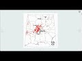
What do the blue dots on the map represent?
Rivers
Volcanoes
Earthquakes
Plate boundaries
2.
MULTIPLE CHOICE QUESTION
30 sec • 1 pt
How can you view a larger version of an image in the first earthquake case?
Right-click the image
Click on the image
Hover over the image
Double-click the image
3.
MULTIPLE CHOICE QUESTION
30 sec • 1 pt
What happens at the end of the first case site?
You exit the story map
You see a summary of all cases
You are taken to the second location
You return to the main map
4.
MULTIPLE CHOICE QUESTION
30 sec • 1 pt
What feature allows you to move the map at any point?
The map is zoomable
The map is static
The map is draggable
The map is mobile
5.
MULTIPLE CHOICE QUESTION
30 sec • 1 pt
How can you jump between different case sites?
By clicking on the map
By using the navigation menu
By using the search bar
By scrolling or clicking on the screen
6.
MULTIPLE CHOICE QUESTION
30 sec • 1 pt
Where can you find the image credits?
At the top of the page
In the middle of the page
At the bottom of the page
In the sidebar
Access all questions and much more by creating a free account
Create resources
Host any resource
Get auto-graded reports
Continue with Google

Continue with Email
Continue with Classlink
Continue with Clever
or continue with
Microsoft
%20(1).png)
Apple
Others
Already have an account?
