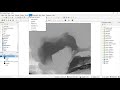
Exporting and Extracting Data in QGIS
Interactive Video
•
Geography, Computers, Science
•
10th - 12th Grade
•
Practice Problem
•
Hard

Patricia Brown
FREE Resource
Read more
10 questions
Show all answers
1.
MULTIPLE CHOICE QUESTION
30 sec • 1 pt
What type of data can be extracted using the methods discussed in the video?
Financial data
Topographic and bathymetric data
Meteorological data
Biological data
2.
MULTIPLE CHOICE QUESTION
30 sec • 1 pt
Which software is used in the video to handle GeoTIFF files?
ArcGIS
QGIS
MATLAB
AutoCAD
3.
MULTIPLE CHOICE QUESTION
30 sec • 1 pt
What is the correct projection to set for the GeoTIFF files in the video?
EPSG:4326
WGS84
UTM
NAD83
4.
MULTIPLE CHOICE QUESTION
30 sec • 1 pt
How can you specify the area of the map you want to extract in QGIS?
By using a GPS device
By selecting a predefined region
By entering longitude and latitude extents
By drawing a polygon
5.
MULTIPLE CHOICE QUESTION
30 sec • 1 pt
What is the longitude range for extracting the Gulf of Mexico as mentioned in the video?
-100 to -80
-120 to -100
-110 to -90
-90 to -70
6.
MULTIPLE CHOICE QUESTION
30 sec • 1 pt
Which file format is NOT mentioned as an option for exporting data in the video?
XYZ
CSV
ASCII
7.
MULTIPLE CHOICE QUESTION
30 sec • 1 pt
What is the first step in exporting data as an XYZ file in QGIS?
Set the projection to NAD83
Open the processing toolbox
Choose the clipped version
Select the entire map
Access all questions and much more by creating a free account
Create resources
Host any resource
Get auto-graded reports
Continue with Google

Continue with Email
Continue with Classlink
Continue with Clever
or continue with
Microsoft
%20(1).png)
Apple
Others
Already have an account?
Similar Resources on Wayground
Popular Resources on Wayground

15 questions
Fractions on a Number Line
Quiz
•
3rd Grade
20 questions
Equivalent Fractions
Quiz
•
3rd Grade
25 questions
Multiplication Facts
Quiz
•
5th Grade
29 questions
Alg. 1 Section 5.1 Coordinate Plane
Quiz
•
9th Grade
22 questions
fractions
Quiz
•
3rd Grade
11 questions
FOREST Effective communication
Lesson
•
KG
20 questions
Main Idea and Details
Quiz
•
5th Grade
20 questions
Context Clues
Quiz
•
6th Grade