Understanding Map Scales and Measurements
Interactive Video
•
Geography, Mathematics, Science
•
9th - 10th Grade
•
Practice Problem
•
Hard

Patricia Brown
FREE Resource
Read more
10 questions
Show all answers
1.
MULTIPLE CHOICE QUESTION
30 sec • 1 pt
Why is scale considered a compromise when creating maps?
Because it increases the size of the map.
Because it makes maps more expensive to produce.
Because it simplifies the representation of real-world data.
Because it allows for more colors on the map.
2.
MULTIPLE CHOICE QUESTION
30 sec • 1 pt
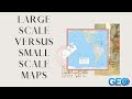
What is a characteristic of large-scale maps?
They use more colors than small-scale maps.
They are less accurate than small-scale maps.
They show a smaller geographic area with more detail.
They show a larger geographic area with less detail.
3.
MULTIPLE CHOICE QUESTION
30 sec • 1 pt
Which of the following is NOT a way to represent scale on a map?
Graphic or bar scale
Verbal scale
Color scale
Representative fraction
4.
MULTIPLE CHOICE QUESTION
30 sec • 1 pt
What does a verbal scale of '1 inch equals 100 feet' mean?
1 foot on the map represents 100 feet on the ground.
1 foot on the map represents 100 inches on the ground.
1 inch on the map represents 100 feet on the ground.
1 inch on the map represents 100 inches on the ground.
5.
MULTIPLE CHOICE QUESTION
30 sec • 1 pt
How does a representative fraction differ from a verbal scale?
It is only used for large-scale maps.
It uses specific units of measurement.
It is independent of any specific type of measurement unit.
It is only used for small-scale maps.
6.
MULTIPLE CHOICE QUESTION
30 sec • 1 pt
What does a 1:100 representative fraction indicate?
100 units on the map equal 100 units on the ground.
1 unit on the map equals 1 unit on the ground.
100 units on the map equal 1 unit on the ground.
1 unit on the map equals 100 units on the ground.
7.
MULTIPLE CHOICE QUESTION
30 sec • 1 pt
Why might different students report different measurements for the same coastline?
They used different colors on their maps.
They used maps with different scales.
They used different types of maps.
They measured at different times of the day.
Access all questions and much more by creating a free account
Create resources
Host any resource
Get auto-graded reports
Continue with Google

Continue with Email
Continue with Classlink
Continue with Clever
or continue with
Microsoft
%20(1).png)
Apple
Others
Already have an account?
Popular Resources on Wayground

15 questions
Fractions on a Number Line
Quiz
•
3rd Grade
20 questions
Equivalent Fractions
Quiz
•
3rd Grade
25 questions
Multiplication Facts
Quiz
•
5th Grade
29 questions
Alg. 1 Section 5.1 Coordinate Plane
Quiz
•
9th Grade
22 questions
fractions
Quiz
•
3rd Grade
11 questions
FOREST Effective communication
Lesson
•
KG
20 questions
Main Idea and Details
Quiz
•
5th Grade
20 questions
Context Clues
Quiz
•
6th Grade