Drawing Isolines on Topographic Maps
Interactive Video
•
Science, Geography, Mathematics
•
9th - 12th Grade
•
Practice Problem
•
Hard

Patricia Brown
FREE Resource
Read more
10 questions
Show all answers
1.
MULTIPLE CHOICE QUESTION
30 sec • 1 pt
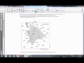
What is the primary task described in the video regarding the topographic map of Hawaii?
Calculating the total area of Hawaii
Drawing a 1,000-meter ocean depth isoline
Measuring the distance between points A and B
Identifying the highest peak on the island
2.
MULTIPLE CHOICE QUESTION
30 sec • 1 pt
Why is it important to extend the isoline to the edge of the map?
To measure the total length of the line
To avoid leaving an open loop
To ensure it forms a closed loop
To connect with other isolines
3.
MULTIPLE CHOICE QUESTION
30 sec • 1 pt
What should you do if the isoline does not form a closed loop?
Start a new loop
Extend it to the map's edge
Connect it to another line
Ignore it
4.
MULTIPLE CHOICE QUESTION
30 sec • 1 pt
What is the isoline rhyme mentioned in the video?
If true, go through
If false, stop
If high, go low
If low, go high
5.
MULTIPLE CHOICE QUESTION
30 sec • 1 pt
What is the depth value between which the -1000 meter isoline lies?
-500 and -750 meters
-750 and -1250 meters
-500 and -1000 meters
-1000 and -1500 meters
6.
MULTIPLE CHOICE QUESTION
30 sec • 1 pt
What should you do if the isoline goes over the edge of the map?
Draw it back to the map
Erase the extra part
Leave it as it is
Start a new line
7.
MULTIPLE CHOICE QUESTION
30 sec • 1 pt
What is the relationship between the island's edge and the isoline?
The edge is at -500 meters
The edge is always at -1000 meters
The edge is at zero meters
The edge is at 500 meters
Access all questions and much more by creating a free account
Create resources
Host any resource
Get auto-graded reports
Continue with Google

Continue with Email
Continue with Classlink
Continue with Clever
or continue with
Microsoft
%20(1).png)
Apple
Others
Already have an account?
