Understanding Contour and Isoline Maps
Interactive Video
•
Geography
•
6th - 7th Grade
•
Practice Problem
•
Hard

Patricia Brown
FREE Resource
Read more
10 questions
Show all answers
1.
MULTIPLE CHOICE QUESTION
30 sec • 1 pt
What is the main focus of the Bristol booklet task mentioned in the video?
Learning about climate change
Studying the history of Bristol
Understanding isoline maps
Creating a weather forecast
2.
MULTIPLE CHOICE QUESTION
30 sec • 1 pt
What is the primary purpose of isoline maps in geography?
To illustrate historical events
To show patterns of data in a place
To display political boundaries
To map out transportation routes
3.
MULTIPLE CHOICE QUESTION
30 sec • 1 pt
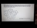
In the example of Greater London, what data is being represented on the map?
Population density
Air temperature
Traffic congestion
Rainfall levels
4.
MULTIPLE CHOICE QUESTION
30 sec • 1 pt
How do isolines help in understanding the data on a map?
By showing only the average values
By highlighting the highest values only
By connecting points of the same value
By connecting points of different values
5.
MULTIPLE CHOICE QUESTION
30 sec • 1 pt
What temperature is represented by the isoline in the USA and Canada map example?
85 degrees Fahrenheit
60 degrees Celsius
85 degrees Celsius
60 degrees Fahrenheit
6.
MULTIPLE CHOICE QUESTION
30 sec • 1 pt
What is a contour map used to show?
The speed of wind
The height above sea level
The depth of the ocean
The flow of rivers
7.
MULTIPLE CHOICE QUESTION
30 sec • 1 pt
What geographical feature is used as an example for contour maps?
A volcano
A desert
A river delta
A mountain range
Access all questions and much more by creating a free account
Create resources
Host any resource
Get auto-graded reports
Continue with Google

Continue with Email
Continue with Classlink
Continue with Clever
or continue with
Microsoft
%20(1).png)
Apple
Others
Already have an account?
