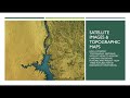
Understanding Erosion and Topographic Maps
Interactive Video
•
Science, Geography, Other
•
6th - 8th Grade
•
Practice Problem
•
Hard

Patricia Brown
FREE Resource
Read more
10 questions
Show all answers
1.
MULTIPLE CHOICE QUESTION
30 sec • 1 pt
What is the primary purpose of interpreting topographic maps and satellite views?
To track animal migration
To predict weather patterns
To identify land and erosional features
To measure the temperature of the earth
2.
MULTIPLE CHOICE QUESTION
30 sec • 1 pt
Which process involves the breakdown of rocks into smaller pieces?
Erosion
Sedimentation
Weathering
Deposition
3.
MULTIPLE CHOICE QUESTION
30 sec • 1 pt
What is a common cause of mechanical weathering?
Plant roots growing into rocks
Rust formation
Acid rain
Carbon dioxide reactions
4.
MULTIPLE CHOICE QUESTION
30 sec • 1 pt
How does erosion differ from weathering?
Erosion involves the movement of materials
Erosion involves the breakdown of rocks
Erosion is a chemical process
Erosion only occurs in deserts
5.
MULTIPLE CHOICE QUESTION
30 sec • 1 pt
What role does vegetation play in preventing erosion?
It increases the rate of erosion
It has no effect on erosion
It holds soil in place with roots
It causes more water runoff
6.
MULTIPLE CHOICE QUESTION
30 sec • 1 pt
What is a limitation of satellite images?
They cannot show weather patterns
They are outdated and rarely updated
They do not provide detailed elevation data
They are only available for urban areas
7.
MULTIPLE CHOICE QUESTION
30 sec • 1 pt
What type of changes can satellite images help observe?
Only short-term changes
Changes in animal populations
Only long-term changes
Both macro and micro changes
Access all questions and much more by creating a free account
Create resources
Host any resource
Get auto-graded reports
Continue with Google

Continue with Email
Continue with Classlink
Continue with Clever
or continue with
Microsoft
%20(1).png)
Apple
Others
Already have an account?
