Groundwater Management and Geophysical Methods
Interactive Video
•
Science, Geography, Physics
•
11th - 12th Grade
•
Practice Problem
•
Hard

Patricia Brown
FREE Resource
Read more
10 questions
Show all answers
1.
MULTIPLE CHOICE QUESTION
30 sec • 1 pt
What is the primary goal of the Marina Coast Water District's modeling efforts?
To eliminate the use of saltwater in the district
To increase the amount of groundwater available
To create accurate models of water and sediment distribution
To reduce the cost of water management
2.
MULTIPLE CHOICE QUESTION
30 sec • 1 pt
What is the significance of mapping sediment types in the subsurface?
It helps in determining the best locations for new wells
It reduces the cost of water extraction
It controls the movement of saltwater and freshwater
It increases the speed of water flow
3.
MULTIPLE CHOICE QUESTION
30 sec • 1 pt
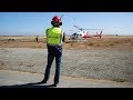
Why is the SkyTEM system used by the district?
To drill deeper wells
To increase water pressure
To desalinate saltwater
To acquire geophysical data for mapping
4.
MULTIPLE CHOICE QUESTION
30 sec • 1 pt
What role does Aqua Frameworks play in the project?
They build desalination plants
They manage the district's water resources
They offer expertise in acquiring SkyTEM data
They provide financial support
5.
MULTIPLE CHOICE QUESTION
30 sec • 1 pt
How does the SkyTEM system measure subsurface conductivity?
By using satellite imagery
By drilling wells
By injecting chemicals into the ground
By using a large transmitter loop to generate magnetic fields
6.
MULTIPLE CHOICE QUESTION
30 sec • 1 pt
What is the purpose of using electrical resistivity tomography (ERT)?
To desalinate water
To increase water temperature
To map subsurface properties
To reduce water usage
7.
MULTIPLE CHOICE QUESTION
30 sec • 1 pt
What is the advantage of using helicopter-based instrumentation for ERT?
It is cheaper than traditional methods
It provides a 3D image of the subsurface
It requires less manpower
It is faster than using drones
Access all questions and much more by creating a free account
Create resources
Host any resource
Get auto-graded reports
Continue with Google

Continue with Email
Continue with Classlink
Continue with Clever
or continue with
Microsoft
%20(1).png)
Apple
Others
Already have an account?
