Weather Interpretation for Flight Planning
Interactive Video
•
Science, Geography, Other
•
9th - 12th Grade
•
Practice Problem
•
Hard

Patricia Brown
FREE Resource
Read more
10 questions
Show all answers
1.
MULTIPLE CHOICE QUESTION
30 sec • 1 pt
What is the weather condition at the departure airport, Baybridge, as described in the video?
Heavy thunderstorms
Marginal VFR with broken ceilings
Snow and ice
Clear skies and calm winds
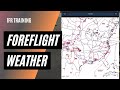
2.
MULTIPLE CHOICE QUESTION
30 sec • 1 pt
What does a green circle on the weather map indicate?
Low IFR conditions
VFR conditions
IFR conditions
Marginal VFR conditions
3.
MULTIPLE CHOICE QUESTION
30 sec • 1 pt
Why are PIREPs important for pilots?
They offer fuel price information
They provide real-time weather updates
They give runway length details
They show air traffic density
4.
MULTIPLE CHOICE QUESTION
30 sec • 1 pt
What is the purpose of having a bailout direction during a flight?
To reduce fuel consumption
To increase flight speed
To escape dangerous weather
To find the shortest route
5.
MULTIPLE CHOICE QUESTION
30 sec • 1 pt
How does radar help in flight planning?
By predicting future weather
By displaying precipitation location and intensity
By showing real-time air traffic
By providing airport landing fees
6.
MULTIPLE CHOICE QUESTION
30 sec • 1 pt
What information can be obtained from surface analysis charts?
Pilot certification requirements
Airline ticket prices
Fronts and pressure systems
Aircraft maintenance schedules
7.
MULTIPLE CHOICE QUESTION
30 sec • 1 pt
Why is it important to know cloud bases and tops?
To determine fuel requirements
To avoid prolonged IMC and icing
To calculate flight speed
To assess runway conditions
Access all questions and much more by creating a free account
Create resources
Host any resource
Get auto-graded reports
Continue with Google

Continue with Email
Continue with Classlink
Continue with Clever
or continue with
Microsoft
%20(1).png)
Apple
Others
Already have an account?
