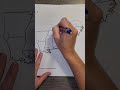
Southeast U.S. States and Geography
Interactive Video
•
Geography
•
4th - 5th Grade
•
Practice Problem
•
Hard

Patricia Brown
FREE Resource
Read more
10 questions
Show all answers
1.
MULTIPLE CHOICE QUESTION
30 sec • 1 pt
What is the first step in filling out the map of the Southeast region?
Draw the map from scratch
Find the map stapled to the study guide
Label the states with their capitals
Color the states in different colors
2.
MULTIPLE CHOICE QUESTION
30 sec • 1 pt
Which state is located directly above Florida?
North Carolina
Georgia
South Carolina
Alabama
3.
MULTIPLE CHOICE QUESTION
30 sec • 1 pt
What is the abbreviation for South Carolina?
FL
GA
NC
SC
4.
MULTIPLE CHOICE QUESTION
30 sec • 1 pt
Which state is added to the map above North Carolina?
Kentucky
Virginia
Tennessee
Alabama
5.
MULTIPLE CHOICE QUESTION
30 sec • 1 pt
What is the abbreviation for West Virginia?
VA
NC
WV
KY
6.
MULTIPLE CHOICE QUESTION
30 sec • 1 pt
Which state is known as the 'boot state'?
Arkansas
Louisiana
Alabama
Mississippi
7.
MULTIPLE CHOICE QUESTION
30 sec • 1 pt
What major river separates Mississippi and Louisiana?
Ohio River
Colorado River
Missouri River
Mississippi River
Access all questions and much more by creating a free account
Create resources
Host any resource
Get auto-graded reports
Continue with Google

Continue with Email
Continue with Classlink
Continue with Clever
or continue with
Microsoft
%20(1).png)
Apple
Others
Already have an account?
