Clip Tool Functions in ArcGIS Pro
Interactive Video
•
Computers
•
9th - 10th Grade
•
Practice Problem
•
Hard

Patricia Brown
FREE Resource
Read more
10 questions
Show all answers
1.
MULTIPLE CHOICE QUESTION
30 sec • 1 pt
What is the primary function of the clip tool in ArcGIS Pro?
To merge multiple layers into one
To clip or subset features to the boundary of another feature
To analyze spatial relationships between features
To convert raster data to vector data
2.
MULTIPLE CHOICE QUESTION
30 sec • 1 pt
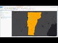
In the example scenario, what is the goal of using the clip tool?
To analyze traffic patterns in Vermont
To convert roads into polygons
To clip roads in Vermont to the boundary of Chittenden County
To merge all roads in Vermont
3.
MULTIPLE CHOICE QUESTION
30 sec • 1 pt
What is the first step in preparing to clip the roads to Chittenden County?
Labeling each polygon based on the county name
Creating a new map document
Exporting the data to a new file
Merging all county polygons into one
4.
MULTIPLE CHOICE QUESTION
30 sec • 1 pt
How do you locate the clip tool in ArcGIS Pro?
By opening the attribute table
By right-clicking on the map
By navigating to the file menu
By using the search functionality in the geoprocessing tab
5.
MULTIPLE CHOICE QUESTION
30 sec • 1 pt
What are the input features in the clip operation?
The output feature class
The entire state of Vermont
The roads that need to be clipped
The polygon boundary of Chittenden County
6.
MULTIPLE CHOICE QUESTION
30 sec • 1 pt
What does the output feature class represent after the clip operation?
All roads in Vermont
Only the roads within Chittenden County
A new polygon layer
Roads that extend beyond Chittenden County
7.
MULTIPLE CHOICE QUESTION
30 sec • 1 pt
What remains unchanged in the output feature class after clipping?
The number of roads
The type of data
The attributes of the roads
The spatial extent of the roads
Access all questions and much more by creating a free account
Create resources
Host any resource
Get auto-graded reports
Continue with Google

Continue with Email
Continue with Classlink
Continue with Clever
or continue with
Microsoft
%20(1).png)
Apple
Others
Already have an account?
