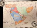
Map Labeling and Color Coding
Interactive Video
•
Geography
•
6th - 7th Grade
•
Practice Problem
•
Hard

Patricia Brown
FREE Resource
Read more
10 questions
Show all answers
1.
MULTIPLE CHOICE QUESTION
30 sec • 1 pt
Which region is excluded from the study of Southwest Asia?
Central Asia
Middle East
Soviet Union
South Asia
2.
MULTIPLE CHOICE QUESTION
30 sec • 1 pt
What is the primary difference between a physical map and a political map?
Physical maps show natural features, political maps show political boundaries
Physical maps are older, political maps are newer
Physical maps show capital cities, political maps show mountains
Physical maps are always in color, political maps are black and white
3.
MULTIPLE CHOICE QUESTION
30 sec • 1 pt
How should mountains be labeled on a physical map?
In green
In blue
In red
In brown
4.
MULTIPLE CHOICE QUESTION
30 sec • 1 pt
What color should be used to label rivers on a physical map?
Green
Blue
Red
Yellow
5.
MULTIPLE CHOICE QUESTION
30 sec • 1 pt
Which color combination is suggested for shading deserts?
Black, White, Yellow
Purple, Pink, Gray
Red, Blue, Green
Yellow, Orange, Brown
6.
MULTIPLE CHOICE QUESTION
30 sec • 1 pt
What is the rule for coloring neighboring countries on a political map?
They must be in shades of blue
They must be different colors
They must be the same color
They must be in shades of green
7.
MULTIPLE CHOICE QUESTION
30 sec • 1 pt
How should small countries be labeled on a map?
At the bottom of the map
Outside the borders with a line
Inside the borders
In the center of the map
Access all questions and much more by creating a free account
Create resources
Host any resource
Get auto-graded reports
Continue with Google

Continue with Email
Continue with Classlink
Continue with Clever
or continue with
Microsoft
%20(1).png)
Apple
Others
Already have an account?
Popular Resources on Wayground

7 questions
History of Valentine's Day
Interactive video
•
4th Grade
15 questions
Fractions on a Number Line
Quiz
•
3rd Grade
20 questions
Equivalent Fractions
Quiz
•
3rd Grade
25 questions
Multiplication Facts
Quiz
•
5th Grade
22 questions
fractions
Quiz
•
3rd Grade
15 questions
Valentine's Day Trivia
Quiz
•
3rd Grade
20 questions
Main Idea and Details
Quiz
•
5th Grade
20 questions
Context Clues
Quiz
•
6th Grade
Discover more resources for Geography
21 questions
Continents and Oceans
Quiz
•
6th Grade
10 questions
Seasons and Earth's Tilt
Quiz
•
7th Grade
12 questions
Russia, Central Asia, & the Caucasus
Quiz
•
6th Grade
20 questions
Mardi Gras History
Quiz
•
6th Grade - University
16 questions
Southern and Eastern Asia Government Basics
Quiz
•
7th Grade
21 questions
Plate Tectonics and Earth's Structure review quiz
Quiz
•
6th Grade
10 questions
38a, b, c: Voluntary trade in Africa
Quiz
•
7th Grade
10 questions
Understanding Landslides
Interactive video
•
5th - 6th Grade