Watershed Delineation Concepts
Interactive Video
•
Geography
•
9th - 10th Grade
•
Practice Problem
•
Hard

Patricia Brown
FREE Resource
Read more
10 questions
Show all answers
1.
MULTIPLE CHOICE QUESTION
30 sec • 1 pt
What is the primary purpose of using a topographic map in watershed delineation?
To calculate the speed of water flow
To determine the chemical composition of water
To measure the depth of water bodies
To identify areas contributing water to a flow system
2.
MULTIPLE CHOICE QUESTION
30 sec • 1 pt
How can geographic information systems assist in watershed delineation?
By predicting weather patterns
By automatically delineating watersheds using elevation data
By measuring water quality
By providing real-time water flow data
3.
MULTIPLE CHOICE QUESTION
30 sec • 1 pt
Why is it important to check computer-generated watershed delineations manually?
Manual checks are faster
Manual checks are unnecessary
Computers can make errors
Computers are always accurate
4.
MULTIPLE CHOICE QUESTION
30 sec • 1 pt
What do closely spaced contour lines on a topographic map indicate?
A valley
A plateau
A steep slope
A flat terrain
5.
MULTIPLE CHOICE QUESTION
30 sec • 1 pt
What is the significance of a watershed boundary?
It separates different water bodies
It indicates the chemical composition of water
It encloses areas contributing to drainage at a specific point
It marks the deepest point in a water body
6.
MULTIPLE CHOICE QUESTION
30 sec • 1 pt
What do elevation contours on a map represent?
The speed of water flow
The depth of water bodies
Lines of equal elevation
The chemical composition of soil
7.
MULTIPLE CHOICE QUESTION
30 sec • 1 pt
What is the first step in the procedure for watershed delineation?
Measuring water flow
Drawing contour lines
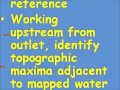
Identifying the outlet
Identifying the highest point
Access all questions and much more by creating a free account
Create resources
Host any resource
Get auto-graded reports
Continue with Google

Continue with Email
Continue with Classlink
Continue with Clever
or continue with
Microsoft
%20(1).png)
Apple
Others
Already have an account?
