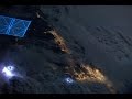
NEXRAD and GOES-R Radar Systems
Interactive Video
•
Physics
•
9th - 10th Grade
•
Practice Problem
•
Hard

Patricia Brown
FREE Resource
Read more
8 questions
Show all answers
1.
MULTIPLE CHOICE QUESTION
30 sec • 1 pt
What is a major limitation of the NEXRAD radar network?
It cannot detect lightning.
It has gaps in coverage due to Earth's curvature.
It is spaced too closely together.
It is too expensive to operate.
2.
MULTIPLE CHOICE QUESTION
30 sec • 1 pt
Why is the false alarm rate for tornadoes high with the current radar system?
Because the radar cannot detect rain.
Due to interference from other signals.
Due to gaps in radar coverage where tornadoes can form.
Because the radar is outdated.
3.
MULTIPLE CHOICE QUESTION
30 sec • 1 pt
How does lightning serve as an early warning indicator?
It indicates the presence of strong winds.
It is a sign of clear weather.
It shows the direction of storm movement.
It signals the potential development of severe storms and tornadoes.
4.
MULTIPLE CHOICE QUESTION
30 sec • 1 pt
What is the primary function of ground-based lightning detectors?
To predict earthquake activity.
To trace how lightning moves through the atmosphere.
To monitor temperature changes.
To measure rainfall intensity.
5.
MULTIPLE CHOICE QUESTION
30 sec • 1 pt
What is the significance of the intersection of lightning and cloud fronts?
It indicates a decrease in storm intensity.
It helps in understanding the structure of storms.
It shows the end of a storm.
It is unrelated to weather prediction.
6.
MULTIPLE CHOICE QUESTION
30 sec • 1 pt
What does the GOES-R satellite's advanced lightning mapper do?
It maps atmospheric lightning across the Western Hemisphere.
It tracks animal migration patterns.
It forecasts daily weather conditions.
It measures ocean temperatures.
7.
MULTIPLE CHOICE QUESTION
30 sec • 1 pt
How does the GOES-R satellite contribute to storm warnings?
By measuring wind speeds at ground level.
By providing real-time images of cloud formations.
By predicting the exact path of tornadoes.
By offering critical minutes of warning time for severe storms.
Access all questions and much more by creating a free account
Create resources
Host any resource
Get auto-graded reports
Continue with Google

Continue with Email
Continue with Classlink
Continue with Clever
or continue with
Microsoft
%20(1).png)
Apple
Others
Already have an account?
