Understanding ARGO Floats and Climate
Interactive Video
•
Science
•
6th - 7th Grade
•
Practice Problem
•
Hard

Patricia Brown
FREE Resource
Read more
6 questions
Show all answers
1.
MULTIPLE CHOICE QUESTION
30 sec • 1 pt
What is the primary difference between climate and weather?
Weather and climate are the same, with no differences.
Climate refers to short-term atmospheric conditions, while weather is long-term.
Climate is the average weather over long periods, while weather is short-term.
Weather is the average climate over long periods, while climate is short-term.
2.
MULTIPLE CHOICE QUESTION
30 sec • 1 pt
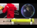
What is the main purpose of deploying ARGO floats in the ocean?
To measure the speed of ocean currents.
To collect data on ocean pressure, temperature, and salinity.
To track the migration patterns of marine animals.
To monitor underwater volcanic activity.
3.
MULTIPLE CHOICE QUESTION
30 sec • 1 pt
How do ARGO floats transmit their collected data?
Via satellite communication.
Through underwater cables.
By storing data until manually retrieved.
By sending signals to passing ships.
4.
MULTIPLE CHOICE QUESTION
30 sec • 1 pt
What do the colors red and purple indicate on ocean temperature maps created from ARGO data?
Red indicates cooling, and purple indicates warming.
Red indicates warming, and purple indicates cooling.
Both colors indicate areas of high salinity.
Both colors indicate areas of low pressure.
5.
MULTIPLE CHOICE QUESTION
30 sec • 1 pt
What trend is revealed when recent ARGO data is compared to long-term records?
No significant trend is observed.
A stable temperature trend.
A warming trend in the ocean.
A cooling trend in the ocean.
6.
MULTIPLE CHOICE QUESTION
30 sec • 1 pt
Why is the data from ARGO floats important for understanding climate change?
It provides insights into ocean warming rates.
It helps predict future weather patterns.
It tracks the movement of tectonic plates.
It measures the height of ocean waves.
Access all questions and much more by creating a free account
Create resources
Host any resource
Get auto-graded reports
Continue with Google

Continue with Email
Continue with Classlink
Continue with Clever
or continue with
Microsoft
%20(1).png)
Apple
Others
Already have an account?
