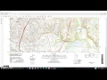
Map Boundaries and Coordinates
Interactive Video
•
Geography
•
6th - 8th Grade
•
Practice Problem
•
Hard

Patricia Brown
FREE Resource
Read more
10 questions
Show all answers
1.
MULTIPLE CHOICE QUESTION
30 sec • 1 pt
What is the primary purpose of the video?
To teach how to draw topographic maps
To determine the latitude and longitude of map boundaries
To discuss the climate of the Austin East area
To explain the history of topographic maps
2.
MULTIPLE CHOICE QUESTION
30 sec • 1 pt
Which numbers indicate the latitude of the southern boundary?
97° 37 minutes 30 seconds
30° 22 minutes 30 seconds
97° 45 minutes
30° 15 minutes
3.
MULTIPLE CHOICE QUESTION
30 sec • 1 pt
What is the significance of the numbers being the same in both south corners?
They show the latitude of the southern boundary
They indicate the longitude of the map
They are used to calculate the map's area
They represent the map's scale
4.
MULTIPLE CHOICE QUESTION
30 sec • 1 pt
What is the longitude of the west boundary of the map?
30° 22 minutes 30 seconds
97° 45 minutes
30° 15 minutes
97° 37 minutes 30 seconds
5.
MULTIPLE CHOICE QUESTION
30 sec • 1 pt
What is the longitude of the east boundary of the map?
97° 45 minutes
30° 15 minutes
97° 37 minutes 30 seconds
30° 22 minutes 30 seconds
6.
MULTIPLE CHOICE QUESTION
30 sec • 1 pt
How is the latitude of the northern boundary identified?
By checking the numbers in the southwest corner
By comparing the numbers in the northeast and northwest corners
By looking at the map's title
By measuring the distance from the equator
7.
MULTIPLE CHOICE QUESTION
30 sec • 1 pt
What does the number 30° 22 minutes 30 seconds represent?
Longitude of the west boundary
Latitude of the northern boundary
Longitude of the east boundary
Latitude of the southern boundary
Access all questions and much more by creating a free account
Create resources
Host any resource
Get auto-graded reports
Continue with Google

Continue with Email
Continue with Classlink
Continue with Clever
or continue with
Microsoft
%20(1).png)
Apple
Others
Already have an account?
Popular Resources on Wayground

15 questions
Fractions on a Number Line
Quiz
•
3rd Grade
20 questions
Equivalent Fractions
Quiz
•
3rd Grade
25 questions
Multiplication Facts
Quiz
•
5th Grade
54 questions
Analyzing Line Graphs & Tables
Quiz
•
4th Grade
22 questions
fractions
Quiz
•
3rd Grade
20 questions
Main Idea and Details
Quiz
•
5th Grade
20 questions
Context Clues
Quiz
•
6th Grade
15 questions
Equivalent Fractions
Quiz
•
4th Grade
Discover more resources for Geography
20 questions
Plate Tectonics and Earth's Structure
Quiz
•
6th Grade
21 questions
Continents and Oceans
Quiz
•
6th Grade
15 questions
SWA Geography SS7G5
Quiz
•
7th Grade
16 questions
Southern and Eastern Asia Government Basics
Quiz
•
7th Grade
10 questions
38a, b, c: Voluntary trade in Africa
Quiz
•
7th Grade
25 questions
Russia and the Eurasian Republics
Quiz
•
6th Grade
11 questions
OPEC
Quiz
•
6th Grade
16 questions
Culture
Quiz
•
7th Grade