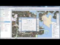
Image Layer Management in Maptitude
Interactive Video
•
Computers
•
9th - 10th Grade
•
Practice Problem
•
Hard

Patricia Brown
FREE Resource
Read more
10 questions
Show all answers
1.
MULTIPLE CHOICE QUESTION
30 sec • 1 pt
What is the primary requirement for accessing imagery from the internet in Maptitude?
A GPS-enabled device
An internet connection
A valid software license
A high-speed internet connection
2.
MULTIPLE CHOICE QUESTION
30 sec • 1 pt
Which command is used to add virtual Earth imagery as a layer in Maptitude?
Map Imagery
Image Editor
Map Tools
Layer Manager
3.
MULTIPLE CHOICE QUESTION
30 sec • 1 pt
What happens to image layers by default when added to a map?
They are added at the top
They are added near the bottom
They replace existing layers
They are added in the middle
4.
MULTIPLE CHOICE QUESTION
30 sec • 1 pt
How can you make an image layer semi-opaque in Maptitude?
By using the opacity slider
By clicking the style button
By adjusting the brightness
By changing the layer order
5.
MULTIPLE CHOICE QUESTION
30 sec • 1 pt
Which file formats can be used to add imagery to a map in Maptitude?
None of the above
JPEG, PNG, GIF
Mr Sid, ECW, TIFF
All of the above
6.
MULTIPLE CHOICE QUESTION
30 sec • 1 pt
What is the first step to add a specific image file as a layer in Maptitude?
Click the style button
Click the layers button
Select the image file format
Download the image
7.
MULTIPLE CHOICE QUESTION
30 sec • 1 pt
What should you do after selecting the image file format to add it as a layer?
Click save
Click close
Click delete
Click open
Access all questions and much more by creating a free account
Create resources
Host any resource
Get auto-graded reports
Continue with Google

Continue with Email
Continue with Classlink
Continue with Clever
or continue with
Microsoft
%20(1).png)
Apple
Others
Already have an account?
