Population Density and Geography Concepts
Interactive Video
•
Geography
•
6th - 7th Grade
•
Practice Problem
•
Hard

Patricia Brown
FREE Resource
Read more
10 questions
Show all answers
1.
MULTIPLE CHOICE QUESTION
30 sec • 1 pt
What is the main objective of today's lesson?
To study the economic development of North America
To learn about the history of North America
To understand how geography influences population density
To explore the cultural diversity of North America
2.
MULTIPLE CHOICE QUESTION
30 sec • 1 pt
How is population density defined?
The number of cities in a country
The number of people living in a square mile
The number of schools in an area
The number of animals in a region
3.
MULTIPLE CHOICE QUESTION
30 sec • 1 pt
Which of the following is an example of an urban area?
The Hill Country
San Antonio
The Rocky Mountains
A rural farm
4.
MULTIPLE CHOICE QUESTION
30 sec • 1 pt
What is a characteristic of rural areas?
Many skyscrapers
Crowded cities
Low population density
High population density
5.
MULTIPLE CHOICE QUESTION
30 sec • 1 pt
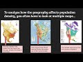
What does a political map show?
Population density
Climate zones
Physical features like mountains
Boundaries between countries and cities
6.
MULTIPLE CHOICE QUESTION
30 sec • 1 pt
Which map would you use to find the elevation of land?
Physical map
Climate map
Political map
Population density map
7.
MULTIPLE CHOICE QUESTION
30 sec • 1 pt
What does a population density map indicate?
The climate of a region
The number of rivers in an area
Areas with high and low population density
The political boundaries of a country
Access all questions and much more by creating a free account
Create resources
Host any resource
Get auto-graded reports
Continue with Google

Continue with Email
Continue with Classlink
Continue with Clever
or continue with
Microsoft
%20(1).png)
Apple
Others
Already have an account?
Similar Resources on Wayground
Popular Resources on Wayground

8 questions
Spartan Way - Classroom Responsible
Quiz
•
9th - 12th Grade
15 questions
Fractions on a Number Line
Quiz
•
3rd Grade
14 questions
Boundaries & Healthy Relationships
Lesson
•
6th - 8th Grade
20 questions
Equivalent Fractions
Quiz
•
3rd Grade
3 questions
Integrity and Your Health
Lesson
•
6th - 8th Grade
25 questions
Multiplication Facts
Quiz
•
5th Grade
9 questions
FOREST Perception
Lesson
•
KG
20 questions
Main Idea and Details
Quiz
•
5th Grade
Discover more resources for Geography
20 questions
Fun with Flags
Quiz
•
6th Grade
52 questions
2nd Semester Interim Review 35, 36, 37, 38, 39, 40, 50
Quiz
•
7th Grade
50 questions
50 States
Quiz
•
4th - 7th Grade
42 questions
Africa Unit Test Review
Quiz
•
7th Grade
20 questions
Geography of Latin America
Quiz
•
6th - 8th Grade
32 questions
S2 Midterm 2019
Quiz
•
7th Grade
20 questions
Plate Tectonics and Earth's Structure
Quiz
•
6th Grade
39 questions
Africa Unit Test Review
Flashcard
•
7th Grade