Understanding Map Scales and Conversions
Interactive Video
•
Mathematics
•
6th - 7th Grade
•
Practice Problem
•
Hard

Patricia Brown
FREE Resource
Read more
10 questions
Show all answers
1.
MULTIPLE CHOICE QUESTION
30 sec • 1 pt
What is the primary purpose of a map scale?
To show the map's age
To indicate the map's creator
To determine the real-life distance between points on a map
To decorate the map
2.
MULTIPLE CHOICE QUESTION
30 sec • 1 pt
If 1 cm on a map represents 100 m in real life, what would 3 cm on the map represent?
100 m
400 m
300 m
200 m
3.
MULTIPLE CHOICE QUESTION
30 sec • 1 pt
How is a map scale typically represented as a ratio?
1:10,000
1:100,000
1:100
1:1,000
4.
MULTIPLE CHOICE QUESTION
30 sec • 1 pt
What is the first step in converting a simple conversion scale to a map scale?
Measure the map's dimensions
Add a legend to the map
Ensure both units are the same
Convert the map to a digital format
5.
MULTIPLE CHOICE QUESTION
30 sec • 1 pt
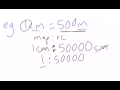
If a map scale is 1:50,000, what does this mean in terms of real-life distance?
1 unit on the map equals 500 units in real life
1 unit on the map equals 50 units in real life
1 unit on the map equals 50,000 units in real life
1 unit on the map equals 5,000 units in real life
6.
MULTIPLE CHOICE QUESTION
30 sec • 1 pt
How can you convert a map scale to a more practical unit like kilometers?
Divide by 1,000
Multiply by 1,000
Divide by 100
Multiply by 100
7.
MULTIPLE CHOICE QUESTION
30 sec • 1 pt
What is the real-life distance if 1 cm on a map equals 1.25 km?
1.25 m
12.5 km
1.25 km
125 km
Access all questions and much more by creating a free account
Create resources
Host any resource
Get auto-graded reports
Continue with Google

Continue with Email
Continue with Classlink
Continue with Clever
or continue with
Microsoft
%20(1).png)
Apple
Others
Already have an account?
