Ecosystem Mapping and Seed Mix Tools
Interactive Video
•
Geography
•
9th - 10th Grade
•
Practice Problem
•
Hard

Patricia Brown
FREE Resource
Read more
10 questions
Show all answers
1.
MULTIPLE CHOICE QUESTION
30 sec • 1 pt
What are the two programs discussed in the introduction of the video?
Google Maps and Bing Maps
Ecosystem Explorer and Seed Selector
Texas Parks & Wildlife's ecosystem mapper and Caesar Clayburgh Research Institute's seed mix map
Texas Wildlife Tracker and Seed Planter Pro
2.
MULTIPLE CHOICE QUESTION
30 sec • 1 pt
Which browser is preferred for using the ecosystem mapping tool?
Mozilla Firefox
Google Chrome
Safari
Microsoft Edge
3.
MULTIPLE CHOICE QUESTION
30 sec • 1 pt
What does the ecosystem mapping tool incorporate to provide comprehensive data?
Animal migration patterns and water sources
Satellite imagery and topographic maps
Ecological site descriptions and web soil survey data
Weather forecasts and climate data
4.
MULTIPLE CHOICE QUESTION
30 sec • 1 pt
What is the main purpose of using the ecosystem mapping tool in reseeding projects?
To track animal populations
To identify soil types and ecological systems
To monitor weather conditions
To map water resources
5.
MULTIPLE CHOICE QUESTION
30 sec • 1 pt
What is the primary function of the seed mix map tool?
To provide weather forecasts
To recommend seed mixes based on ecological site descriptions
To track wildlife movements
To analyze soil pH levels
6.
MULTIPLE CHOICE QUESTION
30 sec • 1 pt
How does the seed mix map tool categorize Tom Green County?
Into urban and rural areas
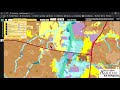
Into Edwards Plateau and the rolling plains
Into forested and non-forested regions
Into highland and lowland zones
7.
MULTIPLE CHOICE QUESTION
30 sec • 1 pt
What can be compared using the seed mix map tool and NRCS ecological site descriptions?
Seed mix recommendations
Water quality
Weather patterns
Animal habitats
Access all questions and much more by creating a free account
Create resources
Host any resource
Get auto-graded reports
Continue with Google

Continue with Email
Continue with Classlink
Continue with Clever
or continue with
Microsoft
%20(1).png)
Apple
Others
Already have an account?
Similar Resources on Wayground

11 questions
Meren Sequence and Prime Numbers
Interactive video
•
9th - 10th Grade
9 questions
Agriculture and Natural Resources Knowledge
Interactive video
•
9th - 12th Grade
8 questions
CLEAN : Luxembourg chef tackles pandemic and global warming by cooking plant-based dishes with local produce
Interactive video
•
9th - 10th Grade
6 questions
CLEAN : Burkina: President of Senegal and Togo to help transition
Interactive video
•
9th - 10th Grade
11 questions
Mangrove Ecosystem Adaptations and Research
Interactive video
•
9th - 10th Grade
11 questions
Wildlife Crossings and Their Impact
Interactive video
•
9th - 10th Grade
11 questions
Ant Behavior and Ecology
Interactive video
•
9th - 10th Grade
11 questions
Bird Research and Behavior Insights
Interactive video
•
9th - 10th Grade
Popular Resources on Wayground
8 questions
Spartan Way - Classroom Responsible
Quiz
•
9th - 12th Grade
15 questions
Fractions on a Number Line
Quiz
•
3rd Grade
14 questions
Boundaries & Healthy Relationships
Lesson
•
6th - 8th Grade
20 questions
Equivalent Fractions
Quiz
•
3rd Grade
3 questions
Integrity and Your Health
Lesson
•
6th - 8th Grade
25 questions
Multiplication Facts
Quiz
•
5th Grade
9 questions
FOREST Perception
Lesson
•
KG
20 questions
Main Idea and Details
Quiz
•
5th Grade